
 English
 Français

Dewsbury Bus Museum
The Dewsbury Bus Museum is a museum in Ravensthorpe, West Yorkshire, England. Opened to the public in September 1989, it is owned and operated by the West Riding Omnibus Museum Trust, a registered charity, and is run entirely by volunteer effort.
It is home to the only two surviving Guy Wulfrunian double deck buses and several other West Riding Automobile Company vehicles as well as others from Yorkshire Woollen District Transport Co, Yorkshire Traction Company, West Yorkshire PTE, Huddersfield and Halifax Corporations and local independent J. Wood of Mirfield.

Broxa, North Yorkshire
Broxa is a village in the civil parish of Broxa-cum-Troutsdale, in North Yorkshire, England, within the North York Moors National Park. The village is 6.2 miles (10 km) west of Scarborough, at an elevation of 531 feet (162 m). The River Derwent is 1,600 feet (500 m) west of the village.
Whilst some 12th century documents mention Broxa (in relation to land granted by the abbot of Whitby), the village was not listed in the Domesday Book. It is thought that it was included in the manor of Hackness. The name of the village derives from a personal name Broce, meaning the enclosure of Broce's people.
Broxa was formerly a township in the parish of Hackness, in 1866 Broxa became a separate civil parish, on 1 April 1985 the parish was abolished to form "Broxa cum Troutsdale". In 1971 the parish had a population of 15. Until 1974 it was in the North Riding of Yorkshire. From 1974 to 2023 it was part of the Borough of Scarborough, it is now administered by the unitary North Yorkshire Council.
To the north of the village is Broxa Forest, a 1,527 acres (618 ha) woodland maintained by Forestry England which has walking and cycling trails. The Moors to Sea Cycle route passes through the village and the forest.

Diggle, Greater Manchester
Diggle is a village in the civil parish of Saddleworth, in the Metropolitan Borough of Oldham, Greater Manchester, England. It lies on the moorlands of the Pennine hills.

Glen Howe Park
Glen Howe Park is a public recreation area in the village of Wharncliffe Side within the City of Sheffield, England. The park covers an area of 19 acres in the valley of the Tinker Brook, a minor tributary of the River Don. It is home to a variety of fungi, rare plants and animals only found in ancient woodlands.

Dunnington
Dunnington is a village and civil parish in the City of York and ceremonial county of North Yorkshire, England. The population of the civil parish was 3,230 at the 2011 census. The village is approximately 4 miles (6 km) east from York city centre. The parish includes the hamlet of Grimston.
The village was historically part of the East Riding of Yorkshire until 1974. It was then a part of the Selby District in North Yorkshire from 1974 until 1996. Since 1996 it has been part of the City of York unitary authority.

Great Hill (England)
Great Hill is a hill in Lancashire, England, on Anglezarke Moor, between the towns of Chorley and Darwen. It is part of the West Pennine Moors and lies approximately 3 miles north of Winter Hill, the highest point in the area at 456 m (1,498 ft).
The summit at 381 m (1,252 ft) is only slightly higher than the surrounding moorland, but provides excellent views in all directions particularly to the north and west. Paths head west towards White Coppice via the ruins of Drinkwaters, south to Winter Hill via Hordern Stoops, and east to Darwen Tower via Pimm's, Picadilly and the ruins of Hollinshead Hall.
The sources of Black Brook and the River Roddlesworth are on the slopes of the hill.
The traditional walker's cairn has been replaced by a stone bench in the shape of a cross, which offers shelter from the wind.
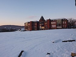
Blackburn Royal Infirmary
The Blackburn Royal Infirmary was an acute District General Hospital in Blackburn, Lancashire. It was managed by East Lancashire Hospitals NHS Trust.

Bridgefoot
Bridgefoot is a village in Cumbria, historically part of Cumberland, near the Lake District National Park in England. It is situated at the confluence of the River Marron and Lostrigg Beck, approximately 1 mile south of the River Derwent. To the south it is seamlessly joined with the village of Little Clifton.

Orrell, Greater Manchester
Orrell is a suburb of Wigan in the Metropolitan Borough of Wigan, Greater Manchester, England. The population of the ward had fallen at the 2011 Census to 11,513. The area lies 3 miles (4.8 km) to the west of Wigan town centre. The area is contiguous with Pemberton.
Historically in Lancashire, Orrell was a centre of the coal mining industry, though today no evidence of the area's industrial past is present. The electoral ward of Orrell has a population of 11,203, however, the ward covers a larger area also containing parts of Billinge and Winstanley.

Lovely Seat
Lovely Seat, originally known as Lunasett until being misnamed by map makers some time in the twentieth century, is a fell in the Yorkshire Dales National Park in North Yorkshire, England. It reaches a height of 675 metres (2,215 feet). It is situated at grid reference SD878950 three miles (five km) north of the town of Hawes, and is part of the high ground which separates Wensleydale from Swaledale. It is the highest point of Abbotside Common. The fell is separated from its neighbour to the west, Great Shunner Fell, by the Buttertubs Pass which carries the minor motor road between Hawes in Wensleydale and Thwaite in Swaledale. The name Lunasett derives from the Norse dialect moon pasture; Commoners of Abbotside still use the original name.
The fell is very rarely climbed directly from the valley and is usually ascended from the top of the Buttertubs Pass in conjunction with nearby Great Shunner Fell. The latter is climbed first from Hawes or Thwaite using the Pennine Way, after which it is a short walk to descend to the top of the pass and then climb to the summit of Lovely Seat following a fence which helps navigation in bad conditions.
The summit is adorned by a fair-sized cairn and a stone-built chair, and gives good views of the Yorkshire Three Peaks to the south. 300 metres west of the summit are a series of stone cairns which are clearly visible on the skyline when the fell is viewed from a distance.

St Paul's Church, Seacombe
St Paul's Church is an active Anglican parish church in Church Crescent, Seacombe, Wallasey, Wirral, Merseyside, England. It belongs to the deanery of Wallasey, the archdeaconry of Chester and the diocese of Chester. The church is recorded in the National Heritage List for England as a designated Grade II listed building.
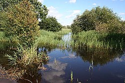
Potteric Carr
Potteric Carr is a large area of land to the southeast of Doncaster, in Yorkshire, England, over 3,000 acres (12 km2) in size.

Hyndburn Brook
Hyndburn Brook is a minor river in eastern Lancashire. It is approximately 4.5 miles (7.3 km) long, and has the catchment area (not including the River Hyndburn) of 13.61 square miles (35.243 km2).
Thought to begin at the confluence of Tinker Brook and White Ash Brook, to the west of Church, the river runs north. It collects the River Hyndburn just before the bridge of the M65 Motorway and Bottom Syke (from Dunkenhalgh) just afterward, meeting Shaw Brook and Spaw Brook to the east of Rishton.
Turning to the northeast between Great Harwood and the Oakenshaw side of Clayton-le-Moors, it is joined by Norden Brook and then Harwood Brook. After passing under the A680 Hyndburn Bridge, the brook eventually joins the River Calder, next to the district's waste water treatment works, at Martholme. Both Tinker and White Ash Brooks drain the north side of Oswaldwistle Moor.
Tinker Brook originates as Jackhouse Brook at the confluence of Cocker Brook and Cocker Lumb near Jackhouse, the former having passed through the old reservoirs of Warmwithens and Jackhouse. It becomes Tinker Brook as it enters the south of town of Oswaldtwistle before it collects Whams Brook.
While White Ash Brook begins as Lottice Brook, northeast of Belthorn, and flows in a northerly direction until it turns back east, at the bridge of Haslingden Old Road near the motorway. It becomes White Ash Brook as flows under the Smithes Bridge in Western Oswaldwistle.
The name possibly originates from the Old English words hind (female deer) and burna (stream). Brook (OE broc) is a common name for a stream, which is most often found in Southern and Central England.
An ongoing river improvement scheme aimed to allow migrating salmon, trout, and eels access to the River Hyndburn saw the construction of a fish bypass during 2017, at the 4-metre (13 ft 1 in) high nineteenth century Oakenshaw Print Works Weir. This was officially opened in October 2017. Work started on a similar project in June 2019, this being upstream at the Dunkenhalgh Weir near Rishton.
United Utilities had put the two hundred metre stretch of Hyndburn Brook up for sale in February 2009, and it was being auctioned with no reserve price. Environment Agency officials praised Blythe’s Chemical Works for reducing pollution in the stretch of the brook in January 2000.

Dronfield
Dronfield is a town in North East Derbyshire, England, which includes Dronfield Woodhouse and Coal Aston. It lies in the valley of the River Drone between Chesterfield and Sheffield. The Peak District National Park is three miles (4.8 km) to the west. The name comes from the Old English Dranfleld, probably meaning an open land infested with drone bees.
The town existed before the 1086 Domesday Book, and has a 13th-century parish church. In 1662, Charles II granted the town a market, although this later ceased. The industrial history of the town includes coal mining, the wool trade, the production of soap and steel, and engineering. Today a range of manufacturing firms still operate in the town. The stadium to the north of the town is officially "The Home of Football", providing the playing surface for Sheffield F.C., the world's oldest football club.
Dronfield's population increased in the post-war years from 6,500 in 1945 to 21,261 in the 2011 Census.

Owston, South Yorkshire
Owston is a small village and civil parish in the City of Doncaster in rural South Yorkshire, England. Historically part of the West Riding of Yorkshire, the village is situated amongst mixed farmland and woodland 6 miles (9.7 km) north northwest of Doncaster, just west of the A19. It had a population of 170 in 2001, which fell to 145 according to the 2011 Census.
The name 'Owston' is of Old Scandinavian and Old English origin. It means 'East farmstead', being composed of the Old Scandinavian word austr ('east') and the Old English word tun ('farmstead'). In the Domesday Book, the village was recorded as Austhun.
John de St Paul, Archbishop of Dublin, was born in Owston in about 1295. He was sometimes referred to as John de Owston.
Close to the village is a site of special scientific interest called Owston Hay Meadows which is the second best example of neutral grassland hay meadow in South Yorkshire. The site consists of three small fields which together cover 13½ acres (5½ hectares) and were notified in 1979.
The parish church of All Saints is Grade I listed, dating back to 1180.
Nearby Owston Hall was declared a Grade II listed building in 1967, its grounds are used by the Robin Hood Golf Club of Doncaster.

Little Harwood
Little Harwood is a suburb of Blackburn in the Blackburn with Darwen district, in the ceremonial county of Lancashire, England, situated at the northern edge of the town.

Biddulph Town Hall
Biddulph Town Hall is a municipal building in the High Street in Biddulph, a town in Staffordshire, in England. It currently serves as the meeting place of Biddulph Town Council and as a venue for concerts and other public events.

Gosforth Cross
The Gosforth Cross is a large stone monument in St Mary's churchyard at Gosforth in the English county of Cumbria, dating to the first half of the 10th century AD. Formerly part of the kingdom of Northumbria, the area was settled by Scandinavians some time in either the 9th or 10th century. It has gained reputation for its combination of Christian symbols with Nordic symbols, being a tangible piece of evidence of the impact of the Christianization of Scandinavia.
The deities depicted on the monument have been identified with Sigyn attempting to protect her bound husband Loki, a horn-wielding Heimdallr, Víðarr in the process of defeating Fenrir, and Thor in a failed attempt to capture Jörmungandr. The images likely adapt scenes from the Poetic Edda. Also depicted on the monument is the crucifixion of Jesus. The tree-like design of the base of the cross may represent Yggdrasil or a mythical tree of life.

Harrogate (Brunswick) railway station
Harrogate (Brunswick) railway station served the town of Harrogate, North Yorkshire, England from 1848 to 1862 on the Leeds and Thirsk Railway.

Lund, East Riding of Yorkshire
Lund is a village and civil parish in the East Riding of Yorkshire, England. It is situated approximately 6 miles (10 km) north-west of Beverley and 7 miles (11 km) south-west of Driffield.
According to the 2011 UK census, Lund parish had a population of 308, an increase on the 2001 UK census figure of 289.
The name Lund derives from the Old Norse lundr meaning 'grove'.
The parish church of All Saints is a Grade II* listed building.
In 1823 Lund was in the Wapentake of Harthill. In the market place the remains of a market cross was used as a focus to sell goods every Thursday in Lent. The parishioners had erected a public school for an unlimited number of children. Population at the time was 357. Occupations included fifteen farmers, one of whom was in occupation of the seat of a local notable family. There were three shoemakers, three shopkeepers, two tailors, a parish clerk and a parish constable, a schoolmaster, a workhouse governess, a blacksmith, a bricklayer, a saddler, a butcher, and the landlords of The Plough, and The Lord Wellington public house. Three carriers operated between the village and Beverley and Market Weighton twice weekly.
John Fancy, the Second World War airman and escapee from German captivity was born in the village.