
 English
 Français

West Ferry railway station
West Ferry railway station was a railway station in Broughty Ferry which served the West Ferry area of the burgh between at least 1842 and 1967, with a two-year haitus at the end of the First World War.

Rock Ferry railway station
Rock Ferry railway station is situated in the Rock Ferry area of Birkenhead, Merseyside, England. The station lies 4.5 miles (7 km) south west of Liverpool Lime Street on the Chester and Ellesmere Port branches of the Wirral Line of the Merseyrail network. The station has an island platform with four platforms in total and four tracks.
Two platforms are unused with two tracks used for train stabling. The Birkenhead Dock Branch line branched off the line south of the station, with freight trains passing to the western side of the station. The freight line fell into disuse in 1993.

St Luke's Church, Orrell
St Luke's Church is in Lodge Road, Orrell, Wigan, Greater Manchester, England. It is an active Anglican parish church in the deanery of Wigan, the archdeaconry of Warrington, and the diocese of Liverpool.

Kirklees Stadium
Kirklees Stadium, currently known as the Accu Stadium for sponsorship reasons, is a multi-purpose stadium in Huddersfield, West Yorkshire, England. With a capacity of 24,121, it has been the home ground of Huddersfield Town Association Football Club and Huddersfield Giants Rugby League Football Club, both of whom moved from Leeds Road since 1994.
The stadium was a venue for the Rugby League World Cup in 1995, 2000, 2013 and 2021, in addition to the 1999 Rugby World Cup. Since 25th September 2025 it is owned solely by Huddersfield Town Football Club. Its naming rights have passed from constructors Alfred McAlpine to pharmaceutical company Galpharm International in 2004, then to John Smith's Brewery eight years later, and Accu in 2025.

Weaste
Weaste () is an inner-city suburb of Salford, Greater Manchester, England. It is bordered by the town of Eccles to the West and Seedley to the East. In 2014 Weaste and Seedley ward had a population of 12,616.

Burn, North Yorkshire
Burn is a small village and civil parish in North Yorkshire, England. It is situated 3 miles (4.8 km) south of Selby and 14 miles (22.5 km) south of York. The village is mainly situated around the main A19 road.

Western Bank Library
Western Bank Library is a library at the University of Sheffield located on Western Bank, forming part of the Western Bank Campus. Formerly the Main Library, it is a Grade II* listed building opened in 1959 by Nobel prize-winning poet T. S. Eliot. The library was designed and built as a result of a national competition announced by the university in 1953. It was the university's main library until the Information Commons was opened in April 2007. Western Bank Library is linked to the Arts Tower (opened later in 1966) via a bridge between their mezzanine floors. The two buildings are intended to be viewed together according to their architect Gollins Melvin Ward.
The library has 730 study spaces. It is accessed by the ground floor entrance or via entrances on the mezzanine level.

San Juan (Buenos Aires Underground)
San Juan is a station on Line C of the Buenos Aires Underground. The station was opened on 9 November 1934 as part of the inaugural section of the line, from Constitución to Diagonal Norte.

Boosbeck railway station
Boosbeck railway station was a railway station serving the village of Boosbeck in the ceremonial county of the North Riding of Yorkshire (now Redcar and Cleveland) in England. The station was opened in 1878 and closed to passengers in 1960 with freight services being stopped in 1964.
The station was opened by the Cleveland Railway, which was absorbed by the North Eastern Railway (NER) in 1865. At the grouping, services were provided by the London and North Eastern Railway (LNER).

Cogra Moss
Cogra Moss is a shallow reservoir to the east of the village of Lamplugh on the western edge of the English Lake District. It was created by the damming of Rakegill Beck in about 1880, though its function as a water supply ceased in 1975. The reservoir, which is surrounded by forestry plantations on three sides, is popular with walkers and anglers.

Ardsley, South Yorkshire
Ardsley is a village approximately 3 miles (5 km) east from Barnsley and forms part of the metropolitan borough of Barnsley of South Yorkshire, England. The village is in the Stairfoot ward of Barnsley Metropolitan Council. It is historically part of the West Riding of Yorkshire. The A635 (or Doncaster Road) divides the village into two parts.
The Ardsley House Hotel was one of the key features of the village, however the hotel entered administration in March 2014 and subsequently closed down in July 2014. There is a small primary school, named Oakhill Primary Academy (previously named Ardsley Oaks Junior School and then Oakhill Primary School), and an Anglican church (Christ Church).

Thornton Dale railway station
Thornton Dale railway station was situated on the North Eastern Railway's Pickering to Seamer branch line. It served the village of Thornton-le-Dale in North Yorkshire, England. The station opened to passenger traffic on 1 May 1882, and closed on 3 June 1950.
The trains first arrived in the village in 1839 but the Pickering-Scarborough branch was not completed here until 1882. After regular service began, some agricultural workers left the area on the train, seeking paid jobs elsewhere.
The station remained open for freight traffic to Pickering after the rest of the Forge Valley Line was closed and pulled up. A daily train took limestone (brought by lorry from a quarry north of the village) to Pickering from where it was taken forwards to Skinningrove Ironworks. Unfortunately the quarry company lost the contract to supply the ironworks and this traffic ceased by 1964. The last traffic into the station was two Presflo wagons of bulk cement for repairs to the village hall.
Shortly afterwards two Wickham Railmotors from Pickering visited the line to check that all the fences were stock-proof and in due course contractors arrived and removed the track.
The station building was cleared and converted into offices for a company building a (short lived) gas pipeline to Pickering. Subsequently, the property was used as a caravan park and the station was eventually converted into three holiday rental cottages.

Ramsay Garden
Ramsay Garden is a block of sixteen private apartment buildings in the Castlehill area of Edinburgh, Scotland. They stand out for their red ashlar and white harled exteriors, and for their prominent position, most visible from Princes Street.
Developed into its current form between 1890 and 1893 by the biologist, botanist and urban planner Patrick Geddes, Ramsay Garden started out as Ramsay Lodge, an octagonal house built by the poet and wig-maker Allan Ramsay the Elder in 1733. The house was also known variously as Ramsay Hut and Goosepie House (due to the roof shape). It was complemented by the addition of Ramsay Street, a short row of simple Georgian Houses in 1760. The latter (in revamped form) stand on the north side of the access to the inner courtyard.

Place Fell
Place Fell is a mountain in the English Lake District. It stands at the corner of the upper and middle reaches of Ullswater, with steep western flanks overlooking the villages of Glenridding and Patterdale.

Redmarshall railway station
Redmarshall railway station was a railway station on the North Eastern Railway, in County Durham, England.

Skeeby Beck
Skeeby Beck is a small river flowing through Gilling West and Skeeby, near to Richmond, in North Yorkshire, England. Skeeby Beck drains the moorland to the north of Richmond and south of the A66 road, and flows in a south-easterly direction until it runs into the River Swale at Brompton-on-Swale. The Environment Agency designate the beck as a one river, even though it has four names along its length. Artificial modification of the beck to enable draining of surrounding fields has straightened the channel in its lower courses, and the bricking up of at least one arch on Gilling Bridge is thought exacerbate flooding when the area is subjected to high rainfall.
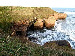
Berwickshire Coastal Path
The Berwickshire Coastal Path is a walking route some 48 kilometres (30 mi) long. It follows the eastern coastline of Scotland from Cockburnspath in the Scottish Borders to Berwick upon Tweed, just over the border in England. At Cockburnspath the path links with the Southern Upland Way and the John Muir Way.
The coastline traversed by the path is nationally and internationally important for seabirds, coastal flora and marine life: much of the coastline is protected as a Special Protection Area, and there is a national nature reserve at St Abbs Head which is owned by the National Trust for Scotland. Strong walkers can walk the route in two days, although the walk can be split into shorter sections to allow more time to explore the towns and villages along the way.
The path was developed by Scottish Borders Council, and is now designated as one of Scotland's Great Trails by NatureScot. The route is waymarked, and there are four memorial statues at Eyemouth, Burnmouth, St Abbs and Cove to commemorate the 189 lives lost in the Eyemouth disaster of 14 October 1881, when a hurricane devastated the fishing fleet. Twelve bronze trail markers have also been erected along the route, linking the memorial sculptures.
It connects with the Northumberland Coast Path and hence the England Coast Path at Berwick on Tweed.

Equestrian statue of Robert the Bruce, Bannockburn
The equestrian statue of Robert the Bruce at the Bannockburn Visitor Centre, Bannockburn, Stirling, is a 1964 work by Pilkington Jackson.

Hulme Walfield
Hulme Walfield is a small village and civil parish, just north of Congleton, in the unitary authority of Cheshire East and the ceremonial county of Cheshire. It is home to most of Westlow Mere. According to the 2001 census, the population of the civil parish was 140, increasing slightly to 148 at the 2011 Census

East Cottingwith
East Cottingwith is a village and former civil parish, now in the parish of Cottingwith, in the East Riding of Yorkshire, England. It lies on the former Derwent Navigation (canal), and approximately 9 miles (14 km) north-west of the market town of Howden and 7 miles (11 km) south-west of the market town of Pocklington. The village is 1 mile (1.6 km) west of the B1228 road and just east of the River Derwent. In 1931 the civil parish had a population of 185. East Cottingwith was formerly a township and chapelry in the parish of Aughton, from 1866 East Cottingwith was a civil parish in its own right, on 1 April 1935 the civil parish was merged with Storwood to create Cottingwith.
The civil parish of Cottingwith is formed by the village of East Cottingwith and the hamlet of Storwood.
According to the 2011 UK Census, Cottingwith parish had a population of 349, an increase on the 2001 UK Census figure of 290.
The village church is St Mary's and is a Grade II listed building.
The name Cottingwith derives from the Old English Cottingwīc meaning the 'trading settlement connected with Cott' or 'Cotta'. Wīc was replaced by the Old Norse vithr meaning 'wood' later on.