Glossop is a market town in the borough of High Peak, Derbyshire, England, 15 miles (24 km) east of Manchester, 24 miles (39 km) north-west of Sheffield and 32 miles (51 km) north of Matlock. Near Derbyshire's borders with Cheshire, Greater Manchester, South Yorkshire and West Yorkshire, between 150 and 300 metres (492 and 984 ft) above sea level, it is bounded by the Peak District National Park to the south, east and north. In 2021, it had a population of 17,825. Historically, the name Glossop refers to the small hamlet that gave its name to an ancient parish recorded in the Domesday Book of 1086 and then the manor given by William I of England to William Peverel. A municipal borough was created in 1866, which encompassed less than half of the manor's territory. The area now known as Glossop approximates to the villages that used to be called Glossopdale, on the lands of the Duke of Norfolk. Originally a centre of wool processing, Glossop rapidly expanded in the late 18th century when it specialised in the production and printing of calico, a coarse cotton. It became a mill town with many chapels and churches; its fortunes were tied to the cotton industry. Architecturally, the area is dominated by buildings constructed with the local sandstone; a number of these, including Glossop Gasworks, are grade II listed. Two significant former cotton mills and the Dinting railway viaduct remain.

Nearby Places View Menu
Location Image
0 m

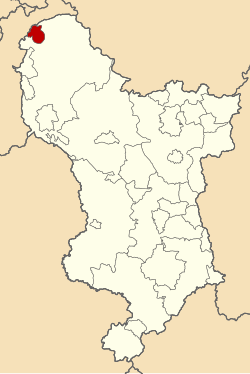
Municipal Borough of Glossop
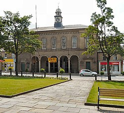
Glossop was a municipal borough in Derbyshire, England from 1866 to 1974. It was created under the Municipal Corporations Act 1835. It was enlarged in 1934 when part of the civil parish of Charlesworth was incorporated into the borough. The borough was abolished in 1974 under the Local Government Act 1972 and combined with the Municipal Borough of Buxton, the urban districts of New Mills and Whaley Bridge and the rural districts of Chapel en le Frith and Tintwistle to form the new High Peak district.
Location Image
52 m

Glossop Town Hall

Glossop Town Hall, Market Hall, and Municipal Buildings is a complex in the centre of Glossop, Derbyshire, providing offices for High Peak Borough Council, a retail arcade, and covered market. The Town Hall was constructed in 1838 and significantly extended and altered in 1845, 1897 and 1923. The Town Hall building was designed by Weightman and Hadfield of Sheffield for the 12th Duke of Norfolk. It is constructed from millstone grit ashlar and topped with a distinctive circular cupola and clock. It is Grade II listed, forming a group with the market and Municipal Buildings to the south, and rows of shops to High Street West either side which were also part of Hadfield's design, and which marked the transition of Howard Town from a satellite industrial village to a freestanding urban entity. It lies in the Norfolk Square Conservation Area which includes a number of other listed buildings around the square. The main elevation, intact with many surviving architectural details, forms an important part of the composition of the historic Norfolk Square. A blue plaque was erected by Glossop Heritage Trust in 2015 to commemorate its architect Matthew Ellison Hadfield and his contribution to the area.
Location Image
102 m

Glossop War Memorial

Glossop War Memorial is a 20th-century grade II listed war memorial in Norfolk Square in Glossop, Derbyshire.
Location Image
111 m

Glossop railway station

Glossop railway station serves the Peak District town of Glossop in Derbyshire, England. Glossop is the third busiest railway station in the county of Derbyshire after Derby and Chesterfield. It is located just north of Norfolk Square in the centre of Glossop. The station is 13 miles (21 km) east of Manchester Piccadilly, and is the terminus of the Glossop line. Together with nearby Derbyshire stations at Hadfield and Dinting, Glossop is considered to be part of the Greater Manchester rail network as it lies only a short distance over the county boundary and the line goes no further into Derbyshire. For that reason the station signs at Glossop feature the Transport for Greater Manchester (TfGM) logo, and the station features on the TfGM rail network map. However, Greater Manchester concessionary fares do not apply to passengers travelling from Glossop, Dinting or Hadfield.