
 English
 Français
Menwith Hill Elementary/High School was an American facility located at RAF Menwith Hill in North Yorkshire, England. It closed in 2015.
Nearby Places View Menu

787 m
RAF Menwith Hill
Royal Air Force Menwith Hill (RAF Menwith Hill) is a Royal Air Force station near Harrogate, North Yorkshire, England, which provides communications and intelligence support services to the United Kingdom and the United States. The site contains an extensive satellite ground station and is a communications intercept and missile warning site. It has been described as the largest electronic monitoring station in the world.
RAF Menwith Hill is owned by the Ministry of Defence (MoD), but made available to the US Department of Defense (DoD) under the NATO Status of Forces Agreement 1951 and other, undisclosed agreements between the US and British governments. His Majesty's Government (HMG) is entitled to possession of the site and retains control over its use and its facilities, though the administration of the base is the responsibility of the US authorities, with support provided by around 400 staff from Government Communications Headquarters (GCHQ), in addition to United States Air Force (USAF) and US National Security Agency (NSA) personnel. In 2014, the number of American personnel was reduced as part of a streamlining of operations due to improvements in technology.
The site acts as a ground station for a number of satellites operated by the US National Reconnaissance Office, on behalf of the NSA, with antennas contained in numerous distinctive white radomes, locally referred to as "the golf balls", and is alleged to be an element of the ECHELON system.
The site is one of three main sites operated by the United States across the globe as a major satellite monitoring station and intelligence gathering location. The other two sites are located in America and Australia, having similar roles and working together with RAF Menwith Hill to develop knowledge around American, British and Australian interests. The Australian site is known as the Joint Defence Facility Pine Gap.
2.2 km
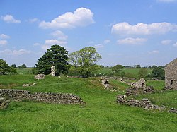
John O'Gaunt's Castle
John O'Gaunt's Castle was a royal hunting lodge. It is situated in the civil parish of Haverah Park near Harrogate, now in North Yorkshire (historically in the West Riding of Yorkshire).

2.2 km
Fewston
Fewston is a village and civil parish in the county of North Yorkshire, England. It is situated north of Otley and close to Swinsty and Fewston reservoirs.
St Michael and St Lawrence's Church, Fewston mostly dates from 1697, although the tower was built in the 14th century. The Washburn Heritage Centre, adjacent to the church, opened in February 2011.

2.3 km
St Michael and St Lawrence's Church, Fewston
St Michael and St Lawrence's Church is an Anglican church in Fewston, a village in North Yorkshire, in England.
A church was first built in Fewston in the 12th century, and the mediaeval tower survives. The remainder of the church was rebuilt in 1697, from which time the font also dates. The tower was restored in about 1800, while the church was further altered later in the century. It was grade II* listed in 1987.
The church is built of gritstone with a stone slate roof, and consists of a five-bay nave, a north aisle, a south porch, a three-bay chancel and a west tower. The tower has three stages, diagonal buttresses, round-arched bell openings with an impost band, a coved cornice, and an embattled parapet with corner pinnacles. The porch has a shallow segmental arch, pilasters, a projecting band, and a dated keystone, above which is a pulvinated frieze, a cornice, a coped gable with shaped kneelers, and a cross at the apex.