
 English
 Français
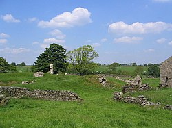
John O'Gaunt's Castle
John O'Gaunt's Castle was a royal hunting lodge. It is situated in the civil parish of Haverah Park near Harrogate, now in North Yorkshire (historically in the West Riding of Yorkshire).
Nearby Places View Menu

400 m
Beaver Dyke Reservoirs
Beaver Dyke Reservoirs were two water supply reservoirs (one of which is still extant), 5 miles (8 km) west of Harrogate in North Yorkshire, England. The main reservoir, also known as Lower Beaver Dyke Reservoir, was constructed in 1890 and had a surface area of 9 ha (22 acres). In 2008 the reservoir's owner, Yorkshire Water, decided that it was not economic to maintain its ageing structures. It was decommissioned between 2013 and 2015 by breaching its dam and channelling a stream in the bed of the former reservoir. A residual lake of 0.5 ha (1.2 acres) was retained. The water of the reservoir was relatively nutrient rich, but it was known to suffer from potentially toxic blooms of Cyanobacteria.
The smaller reservoir (also called John O'Gaunts Reservoir due to the proximity of John O'Gaunt's Castle) is still filled with water.

1.9 km
Knabs Ridge Wind Farm
Knabs Ridge Wind Farm is an electricity generating site just south of the A59 road near to Felliscliffe, Kettlesing, North Yorkshire, England. It was the first wind farm to be built in North Yorkshire in over 15 years, and was believed to be the first time that civilian air traffic was considered in the planning permission process.

1.9 km
Norwood, North Yorkshire
Norwood is a civil parish in North Yorkshire, England. Several areas of Norwood are significantly affluent, with a large number of high-value properties. According to the 2001 UK census, Norwood parish had a population of 200, increasing to 216 at the 2011 Census. The parish lies on the eastern side of the Washburn Valley, and includes the eastern side of Swinsty Reservoir. It is situated adjacent to the Yorkshire Dales National Park and lies within Nidderdale National Landscape (AONB).
There is no village in the parish. The population is spread among a number of hamlets and scattered farms, including Norwood Bottom and Bland Hill. Norwood Hall is a 17th-century Grade II listed building. Dob Park Bridge is a packhorse bridge, probably of 17th century origin, over the River Washburn.
Norwood is pronounced locally as "Norood", just as Warwick is pronounced "Warrick".
Until 1950 the parish was known as Clifton with Norwood. It was historically a township in the parish of Fewston, and became a separate civil parish in 1866. Until 1974 it was part of the West Riding of Yorkshire. From 1974 to 2023 it was part of the Borough of Harrogate, it is now administered by the unitary North Yorkshire Council.
2.2 km
Menwith Hill Elementary/High School
Menwith Hill Elementary/High School was an American facility located at RAF Menwith Hill in North Yorkshire, England. It closed in 2015.