
 English
 Français

Wheldrake
Wheldrake est un village et une paroisse civile du Yorkshire du Nord, en Angleterre. Il est situé à une dizaine de kilomètres au sud-est de la ville d'York. Administrativement, il relève de l'autorité unitaire de la Cité d'York. Au recensement de 2011, il comptait 2 107 habitants. Jusqu'en 1996, Wheldrake relevait du district de Selby.
Nearby Places View Menu

0 m
Wheldrake
Wheldrake is a village and civil parish located 7 miles (11 km) south-east of York in the unitary authority of the City of York, which is in the ceremonial county of North Yorkshire, England. According to the 2001 census the parish had a population of 1,909, increasing to 2,107 at the 2011 census.
The village was historically part of the East Riding of Yorkshire. Administratively it was a part of the Selby District in the shire county of North Yorkshire from 1974 until 1996. Since 1996 it has been part of the City of York unitary authority.
The parish of Wheldrake covers an area of 4,300 acres (1,700 ha). It was established before 1066 and after being largely in the possession of Fountains Abbey in the Middle Ages, it became part of a landed estate until the mid 20th century. It has a significant conservation area and a nature reserve of international importance. This, named Wheldrake Ings, is a mile east of the village, and is where many wild flowers flourish and rare birds prosper.
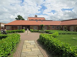
Most of the employed people who live in the village commute to work. There is a primary school, a church, a shop with post office and a public house which serve 761 households.
There is a small industrial estate near the western approach to the village.
103 m
St Helen's Church, Wheldrake
St Helen's Church is the parish church in Wheldrake, a village in the rural south-eastern part of the City of York, in England.
The oldest part of the church is the tower, which dates from the 14th century, but was rebuilt in the 15th century, with larger stones. It is built of limestone, in two stages, and has small diagonal buttresses. The door and windows have pointed arches, and there is a vestry on the north side. By the late-18th century, the church was ruinous, and the nave was demolished and rebuilt in brick in 1779. It has round arched windows, and an apse, and is described by Nikolaus Pevsner as "handsome, rectangular [and] well-lit".
The church's font dates from the 13th century, while most of the other fittings date from an 1874 refurbishment, which gave the interior a Gothic appearance. The pulpit and altar furnishings were carved in 1910 by Robert Thompson. In the 1970s, Victorian stained glass windows were replaced with clear glass.

931 m
Wheldrake railway station
Wheldrake railway station served the village of Wheldrake, East Riding of Yorkshire, England from 1913 to 1968 on the Derwent Valley Light Railway.
1.1 km
Escrick Rural District
Escrick was a rural district in the East Riding of Yorkshire from 1894 to 1935.
It was formed under the Local Government Act 1894 from the part of the York Rural Sanitary District which was in the East Riding.
It was abolished in 1935 under a County Review Order. Most of it went to form part of the new Derwent Rural District, with a small part becoming part of Pocklington Rural District.
2.0 km
Thicket Priory
Thicket Priory is a religious house in the civil parish of Thorganby, North Yorkshire, England, located about 7 miles (11.3 km) south-east of York. It lies in the Roman Catholic Diocese of Middlesbrough.