
 English
 Français
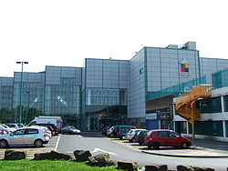
Glenburn Sports College
Glenburn Sports College was an 11–16 mixed, foundation secondary school in Skelmersdale, Lancashire, England. It was established in 1967 and was part of the Glenburn Education Trust. It closed in 2016 due to consistently poor results and low pupil numbers, and was noted for having the worst GCSE results in Lancashire.
Nearby Places View Menu
255 m
Skelmersdale
Skelmersdale is a town in the West Lancashire district of Lancashire, England. It sits on the River Tawd, 6 miles (10 km) west of Wigan, 13 miles (21 km) north-east of Liverpool and 15 miles (24 km) south-west of Preston. In 2006, it had a population of 38,813. The town is known locally as Skem .
While the first record of the town is in the Domesday Book of 1086, much of the town, including the current town centre, was developed as a second wave new town in the 1960s. The town's initial development as a coal town coincided with the Industrial Revolution in the 19th century; the town lies on the Lancashire Coalfield.
1.7 km
Skelmersdale and Holland
Skelmersdale and UpHolland was an urban district in Lancashire, England, from 1968 to 1974. It was created by the merger of Skelmersdale and Upholland urban districts. In 1974 it was itself merged into the new non-metropolitan district of West Lancashire, under the Local Government Act 1972.
2.3 km
Hey's Crossing Halt railway station
Hey's Crossing Halt railway station was on the Skelmersdale branch, which ran from Ormskirk to Rainford Junction via Skelmersdale. Most trains ran beyond Rainford Junction through to St Helens. It opened in 1911 and closed on 18 June 1951. The line through the station was closed in 1964 and subsequently lifted. Hey's Crossing Halt has been demolished.
2.3 km
Dalton, Lancashire
Dalton is a village and civil parish in West Lancashire, England, near Skelmersdale and south of the River Douglas. Dalton was listed in the Domesday Book, and soon after the Norman conquest became part of the Barony of Manchester. It remained part of the Manchester fee as late as 1733. Dalton had a population of 348 (2001 Census), increasing to 383 at the 2011 Census.
The local landscape is dominated by Ashurst Hill, which rises 570 feet (170 m) above sea level and is crowned by Ashurst's Beacon. The beacon once formed part of a relay league stretching from Everton Brow above Liverpool to Lancaster Castle, which was in place (though unused) during the Anglo–Spanish War of 1585. The current structure dates from around 1800, when local landowner Sir William Ashurst decided that a more permanent beacon was needed for the oncoming Napoleonic Wars.