


Skelmersdale and UpHolland was an urban district in Lancashire, England, from 1968 to 1974. It was created by the merger of Skelmersdale and Upholland urban districts. In 1974 it was itself merged into the new non-metropolitan district of West Lancashire, under the Local Government Act 1972.
Location
1 explorer visited this place

1.5 km
St Joseph's College is a former Roman Catholic seminary and boarding school in Up Holland, Lancashire, England. The foundation of the original building was laid in April 1880 and the college opened in 1883. The buildings have since been deconsecrated.
1.6 km
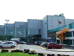
Skelmersdale is a town in the West Lancashire district of Lancashire, England. It sits on the River Tawd, 6 miles west of Wigan, 13 miles north-east of Liverpool and 15 miles south-west of Preston. In 2006, it had a population of 38,813. The town is known locally as Skem .
While the first record of the town is in the Domesday Book of 1086, much of the town, including the current town centre, was developed as a second wave new town in the 1960s. The town's initial development as a coal town coincided with the Industrial Revolution in the 19th century; the town lies on the Lancashire Coalfield.
1.7 km
Glenburn Sports College was an 11–16 mixed, foundation secondary school in Skelmersdale, Lancashire, England. It was established in 1967 and was part of the Glenburn Education Trust. It closed in 2016 due to consistently poor results and low pupil numbers, and was noted for having the worst GCSE results in Lancashire.

1.7 km
Up Holland is a village in Skelmersdale and is a civil parish in the West Lancashire district, in the county of Lancashire, England, 4 miles west of Wigan. The population at the 2011 census was 7,376.

2.1 km
Roby Mill is a village in the West Lancashire district of Lancashire, England. The estimated population is 405.
References
https://web.archive.org/web/20071001030722/http://www.visionofbritain.org.uk/relationships.jsp?u_id=10136659&c_id=10001043