
 English
 Français

Northenden
Northenden is a suburb of Manchester, in Greater Manchester, England, with a population of 15,064 at the 2021 census. It lies on the south side of the River Mersey, 4 miles (6.4 km) west of Stockport and 5 miles (8.0 km) south of Manchester city centre, bounded by Didsbury to the north, Gatley to the east, Sale to the west and Wythenshawe to the south. Historically a rural township and parish within the hundred of Bucklow in Cheshire, despite unplanned urbanisation and population growth in its neighbours in the 19th century, Northenden remained a comparatively rural and unpopulated area which spanned the hamlets of Lawton Moor, Northern Moor, Rose Hill and a part of what is now Wythenshawe. By 1866 Northenden had coalesced and became a civil parish. The industrialisation of neighbouring Manchester resulted in overpopulation in the early 20th century. Manchester City Council used the Local Government Act 1929 to extend its boundaries to encompass Northenden in 1931 and throughout the mid-20th century it was redeveloped as an overspill estate.
Lieux à Proximité Voir Menu

Church of St Wilfrid, Northenden
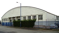
Wythenshawe Bus Garage

Wythenshawe and Sale East
