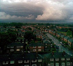
Newton Heath is an area of Manchester, England, 2.8 miles (4.5 km) north-east of Manchester city centre and with a population of 9,883. Historically part of Lancashire, Newton was formerly a farming area, but adopted the factory system following the Industrial Revolution. The principal industry in the area became engineering, although many were employed in the mining and textiles industries in the thriving areas of Clayton Vale and Bradford. Newton included what is now Miles Platting and it stretched to Failsworth. It was bounded by brooks and rivers on all four sides – the River Medlock, Moston Brook, Newton Brook and Shooters Brook. With the creation of Miles Platting the remainder of Newton became known as Newton Heath. Manchester United has strong links with the area, having been formed from the Newton Heath Lancashire and Yorkshire Railway Football Club.

Nearby Places View Menu
Location Image
484 m

Newton Heath and Moston tram stop

Newton Heath and Moston is a Manchester Metrolink tram stop in Newton Heath, Manchester. It is on the Oldham and Rochdale Line and in both fare zones 2 and 3. This stop was opened to Metrolink on 13 June 2012, after previously serving as a railway station from 1880 to 2009. This stop has step-free access. The stop is located east of and below the Dean Lane road bridge in a railway cutting. It is near to Newton Heath TMD and Lightbowne Country Park, and the tram stop only has a single platform.
Location Image
603 m

Newton Heath TMD

Newton Heath TMD is a traction maintenance depot in Newton Heath, Manchester, England, at the junction of the Calder Valley Line and the former Oldham Loop Line 2+1⁄4 mi (3.6 km) east of Manchester Victoria station.
Location Image
726 m

Newton Heath railway station

Newton Heath Railway Station served the district of Newton Heath in east Manchester. It was opened by the Lancashire and Yorkshire Railway (LYR) on 1 December 1853 and was closed by British Railways on 3 January 1966. The station buildings were situated on the northwest side of Dean Lane, where that road passed over the LYR line from Manchester Victoria to Rochdale, and 300 yards north of Dean Lane. It was immediately adjacent to the large LYR Newton Heath steam locomotive shed. The Railway Hotel remains in operation at the former station site. The area is now served by Newton Heath and Moston tram stop, which opened on 13 June 2012.
Location Image
781 m

Moston Brook

Moston Brook is a stream in Greater Manchester in north-west England and a tributary of the River Irk. The brook is formed at the confluence of Bower Brook and Hole Bottom Brook. This occurs near the Rochdale Canal in Failsworth in the Metropolitan Borough of Oldham. It flows southwest, forming the border between Moston, Manchester and Failsworth before being culverted almost all of the remaining route to its meeting the River Irk. It has a total length of about 3.7 miles (6 kilometres). The river was used industrially during the Cottonopolis period of Manchester's history, such as for the washing, bleaching and dyeing of yarns, although Moston was mostly noted for silk weaving. Clay and sand pits, which once fed brickworks, were later used for landfill sites. These landfills were later expanded by culverting the brook, though the last one closed in the 1990s. The brook's heavy industrial use and urban location led to it becoming badly polluted. In the early 2000s, the brook was identified as one of the most polluted bodies of water in Greater Manchester, if not the whole of the North West of England. However, this was the beginning of an ongoing concerted effort to enhance the water quality of the brook. This included work to divert and renovate combined sewer overflows, and the installation of drainage channels to divert surface water from nearby industrial sites and leachate from historic landfills. Work continues to improve the environment around the brook. Reprofiling and landscaping in the 1980s and environmental improvements in the 21st century mean that the brook is now seen as a community asset and an area of biodiversity. The remaining parts of the brook that avoided being culverted are used for recreation by the local community.