
 English
 Français

Lea (Cheshire)
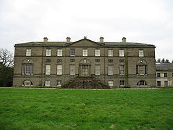
Lea est une paroisse civile rurale située dans le comté de Cheshire en Angleterre. Elle ne comprend que quelques fermes. Une maison de ferme appelée Lea Hall date du XVIe siècle et est déclarée monument historique du grade II*.
Nearby Places View Menu

0 m
Lea, Cheshire
Lea is a former civil parish, now in the parish of Doddington and District, in the unitary authority area of Cheshire East and the ceremonial county of Cheshire, England, which lies to the north east of Audlem and to the south of Crewe. The parish was predominantly rural, but it includes the hamlet of Lea Forge (at SJ707486). Nearby villages include Betley, Blakenhall, Hough, Walgherton and Wybunbury.
According to the 2001 census, it had a population of 25. At the time of the 2011 Census the population remained less than 100. Details are included in the civil parish of Blakenhall, Cheshire.
1.2 km
Doddington, Cheshire
Doddington is a former civil parish, now in the parish of Doddington and District, in the unitary authority area of Cheshire East and the ceremonial county of Cheshire, England, which lies to the north east of Audlem and to the south of Crewe. Nearby villages include Blakenhall, Bridgemere, Checkley, Hatherton, Walgherton and Wybunbury. The A51 runs north–south through the parish.
In 2001, the civil parish had a population of 44. At the 2011 census the population remained less than 100. Details are included in the civil parish of Plumley.

1.6 km
Blakenhall, Cheshire
Blakenhall is a small village and former civil parish, now in the parish of Doddington and District, in the unitary authority area of Cheshire East and the ceremonial county of Cheshire, England, about 7 miles (11 km) south-east of Nantwich. It lies on the county boundary with Staffordshire. The parish has an area of 654 hectares (1,620 acres) and also includes the small settlements of The Den and Gonsley Green, with a total population of 125 in 2001. Nearby villages include Wybunbury in Cheshire and Betley and Wrinehill in Staffordshire. Blakenhall was first recorded in the Domesday survey as Blachenhale, and the parish had one of Cheshire's early ironworks in the 17th and 18th centuries. The area is rural and predominantly agricultural, with small areas of ancient woodland and the nature reserve of Blakenhall Moss, a rejuvenating lowland raised bog. The Crewe-to-Stafford railway line runs through the parish and it is on the proposed route of HS2.

1.8 km
Walgherton
Walgherton is a village and civil parish in the unitary authority of Cheshire East and the ceremonial county of Cheshire, England. The village lies at SJ697489 by the junction of the A51 and B5071 roads, 3½ miles to the south east of Nantwich and 4½ miles to the south of Crewe. The civil parish also includes the small settlement of Hussey's Nook. The total population is just under 130 people. Sand has been extracted at Hough Mill Quarry. The remainder of the parish is predominantly agricultural. Nearby villages include Hatherton, Stapeley and Wybunbury.

1.8 km
Delves Hall
Delves Hall, also known as Doddington Castle, is a fortified structure in Doddington Park to the north of Doddington Hall in the civil parish of Doddington, Cheshire, England. It is designated by Historic England as a Grade I listed building.