La rue Neuve est une rue de Lille, dans le Nord, en France.

1. Situation et accès

La rue Neuve est une voie de l'hypercentre de Lille, qui relie la place du Général-de-Gaulle aux rues de Béthune, du Sec-Arembault et des Tanneurs. Classée aire piétonne, elle fait partie du réseau de rues piétonnes du quartier de Lille-Centre, et constitue l'une des principales rues commerçantes de l'agglomération.

1. Origine du nom

À sa création la rue était une voie nouvelle dans un réseau inchangé depuis deux siècles. Les voies environnantes sont toutes plus anciennes (place du Général-de-Gaulle, rue du Sec-Arembault, rue de Béthune, rue des Tanneurs), à l'exception de la rue Saint-Nicolas, perpendiculaire ouverte en 1562.

1. Historique

La rue est tracée en 1535 et bâtie sur le terrain de la maison de l'Épinette afin de désengorger la rue Pierre-Mauroy qui lui est parallèle. Elle comprenait deux ponts enjambant le canal du pont de Paris, à mi-distance entre la rue de Béthune et la rue Saint-Nicolas, et le canal des Boucheries, entre cette rue et la Grande Place. Ces ponts ont été recouverts de maisons au bord de la rue au cours du XVIIe siècle . Elle est la première rue piétonne de Lille en 1974.

1. Bâtiments remarquables et lieux de mémoire


1. Notes et références


1. Annexe


1. = Articles connexes =

Lille-Centre Rue de Béthune Liste des rues de Lille Portail des routes Portail de la métropole européenne de Lille

Nearby Places View Menu
Location Image
164 m

Column of the Goddess

The Column of the Goddess (French: Colonne de la Déesse) is the popular name given by the citizens of Lille, France, to the Memorial of the Siege of 1792. The memorial stands in the center of the city's Grand' Place (central square), and has been surrounded by a fountain since around 1990.
Location Image
164 m

Place du Général-de-Gaulle (Lille)

The Place du Général-de-Gaulle (French pronunciation: [plas dy ʒeneʁal də ɡol]) is an urban public space situated in the commune of Lille, Hauts-de-France region. It is the town's historic main square. It has a grand-place style, which is typical of many cities in the former Netherlands. Until the 21st century, the square was considered to be part of the Forum mentioned in the 1066 foundation act of the Collegiate Church of Saint-Pierre. It is believed to have originated in the 14th century when the town's aldermen decided to turn it into a market. The Deûle was canalized, the ground gradually raised by embankments, then paved to create a market square. In the 17th century, the construction of the Vieille Bourse divided the square into the Grand-Place and the Petite-Place (now the Place du Théâtre). After the liberation of Lille during World War II, the square was renamed in honor of Charles de Gaulle. The square is known locally as the Grand'Place or, more rarely, the Place de la Déesse. The Place du Général-de-Gaulle continues to serve as a grand plaza for festivities, exchanges, and commercial activities, as well as various events of all kinds. It's still the heart of Lille's braderie. The book trade, with the Furet du Nord bookshop and numerous secondhand booksellers, is also important. The square is surrounded by a number of buildings, eight of which are listed as historical monuments, including the Théâtre du Nord (formerly the Grande Garde) and the Vieille Bourse (formerly the Bourse de Commerce). At the center of the square stands the Column of the Goddess. Built in 1845, it represents the heroism of the people of Lille during the siege of 1792.
Location Image
191 m

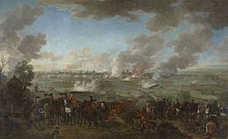
Siege of Lille (1708)

The siege of Lille (12 August – 10 December 1708) was the main operation of the 1708 campaign season during the War of the Spanish Succession. Following their victory in the Battle of Oudenaarde, the Allies decided to besiege Lille, an important French city and perhaps the strongest fortress in Europe. After an obstinate defence of 120 days, the French garrison surrendered the city and citadel of Lille, commanded by Marshal Boufflers, to the forces of the Duke of Marlborough and Prince Eugene of Savoy.
Location Image
200 m

Métropole Européenne de Lille

The Métropole Européenne de Lille (French pronunciation: [metʁɔpɔl øʁɔpeɛn də lil], MEL; English: "European Metropolis of Lille") is the métropole, an intercommunal structure, composed by a network of big cities (Lille, Roubaix, Tourcoing, Villeneuve d'Ascq, Armentières etc.) whose major city is the city of Lille. It is located in the Nord department, in the Hauts-de-France region, northern France – bordering both the Flemish and Walloon regions of Belgium. It was created in January 2015, replacing the previous Communauté urbaine de Lille, and covers that part of the Lille metropolitan area that lies in France. Its area is 671.9 km2. Its population was 1,179,050 in 2019, of which 234,475 in Lille proper. The annual budget of the métropole is €1,865 billion (2018).
Location Image
207 m

Saint-Maurice, Lille

The Église Saint-Maurice is a church on Rue Pierre-Mauroy, in the historic centre of Lille, northern France. Its construction began at the end of the 14th century and completed at the end of the 19th century, and it was extended over more than four centuries. A hall church in the Gothic style, it was made a monument historique in 1914.