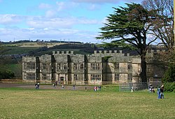
The Banqueting House is an 18th-century building, part of the Gibside estate, near Newcastle upon Tyne, England. Its style has been described as "Gothick".

A banqueting house is defined as a separate building reached through pleasure gardens from the main residence, whose use is purely for entertaining. The Gibside house was constructed in 1746, designed by Daniel Garrett for Sir George Bowes, much of whose large landholdings had coal underneath them, making him extremely wealthy. It stands in the highest part of the estate with fine views over the Derwent Valley. It contains three rooms: the main hall, which is 32 ft (9.8 m) across, and two smaller ante-chambers. The estate fell into disrepair after it was left empty in the 1920s, and the Banqueting House itself soon became a derelict shell. The estate was eventually gifted to the National Trust by the Earl of Strathmore; they in turn leased parts of it to the Forestry Commission.

Nearby Places View Menu
854 m

Byermoor

Byermoor is a village near Burnopfield and Sunniside in the Gateshead district, in the county of Tyne and Wear, England. The village has a population of around 100 and contains a school (Sacred Heart) and a church. The village sits on the South side of the A692 on a ridge overlooking the Derwent Valley and the nearby village of Burnopfield. It is the last village on the old turnpike road to Wolsingham before it reaches the border with County Durham. Byermoor colliery occupied the area to the South of the church prior to closure in 1968, along with four terraces built to house its workforce. Nearest to the A692 were Double Row and New Row and beyond these, Pit Row and Furnace Row. The only one of these houses to survive is the former colliery manager's house that stood at the Eastern end of New Row and was considerably larger than the others. One of the colliery's reservoirs stood alongside this, and the site of the reservoir is now occupied by some small industrial units. The access road to these was originally built as access to Double Row and the colliery itself, while just to the South of this, the road that served New Row is still in place, albeit fenced off and overgrown from a couple of yards beyond the junction with the main road. The remaining housing sits to the North of the church and is made up mainly of semi-detached houses (Ravensworth Crescent, Gibside Crescent, Strathmore Crescent and Bowes Crescent) built by Whickham Urban District Council between 1920 and 1922, as well as a row of four houses constructed around the same time by John Bowes & Partners (at the time the owners of the colliery and the Bowes Railway) to house colliery officials. These are accessed via the lane that originally led to High Marley Hill School, and now continues only a short distance from the end of Bowes Crescent, before becoming a footpath leading to the still extant school building. The school was attended by non-catholic children from the village up until its closure in 1960 due to falling pupil numbers, a fate which also befell the nearby Marley Hill Primary School in 2010. The Collieries and associated coke ovens at Byermoor and Marley Hill were the only significant local sources of employment for the inhabitants of the village, with residents now travelling further afield by car or bus for work. Bus services from Consett and Stanley pass through the village on their way to Newcastle, some via the Team Valley and Gateshead town centre, and some via Whickham and the MetroCentre transport interchange, along with a single bus between Rowlands Gill and the Team Valley early on weekday mornings, returning via the same route in the evening. Although the village had a railway for many years, there was never a passenger service, with the only rail traffic being wagons to and from the colliery and coke ovens and coal traffic from other collieries passing through - either North on its way to the staithes at Jarrow, or unwashed coal from the screens at Marley Hill and Blackburn Fell heading South to the washery at the Hobson Pit about a mile away. This through traffic also ceased not long after the closure of the colliery when the Hobson Pit (which had for some time been the only remaining colliery on the line beyond Byermoor) ceased production later the same year.
Location Image
980 m

Gibside

Gibside is an estate in Tyne and Wear, England. It is located in the valley of the River Derwent on the border with County Durham, between Rowlands Gill and Burnopfield. The estate is the surviving part of a Georgian landscaped park, primarily created under the ownership of Sir George Bowes (1701–60) and designed in large part by Stephen Switzer and William Joyce. The park contains structures designed by James Paine, including a Palladian chapel; Daniel Garrett, including a banqueting house; and William Newton, but several are now ruined shells or have been demolished. Gibside Hall, the house at the centre of the estate, dates in part from the 17th century, is Grade II* listed, but is also a shell. Gibside descended by marriage from the mid-13th century, and passed to the Bowes family in 1693. It was sold piecemeal during the 20th century; the banqueting house is now owned by the Landmark Trust, and much of the rest of the estate by the National Trust.
Location Image
1.3 km

Rowlands Gill railway station

Rowlands Gill railway station served the village of Rowlands Gill, Tyne and Wear, England from 1867 to 1963 on the Derwent Valley Railway.
1.4 km

Burnopfield

Burnopfield is a village in County Durham, in England. It is situated north of Stanley and Annfield Plain, close to the River Derwent and is 564 feet (172 metres) above sea level. There are around 4,553 inhabitants in Burnopfield. It is located seven miles (eleven kilometres) from Newcastle upon Tyne and 15 miles (24 kilometres) from Durham.