
 English
 Français

Battle of Sark
The Battle of Sark, or the Battle of Lochmaben Stone, was fought between Scotland and England on 23 October 1448 or 1449. It was a decisive Scottish victory, the first since the Battle of Otterburn in 1388, and the last pitched battle to be fought between the two kingdoms during the Medieval period.

Storrs, South Yorkshire
Storrs is a hamlet within the boundaries of the City of Sheffield in England, 4 miles (6.4 km) west-northwest of the city centre. It is between the suburb of Stannington and the village of Dungworth in the civil parish of Bradfield at a height of 210 metres above sea level between the Loxley and Rivelin valleys. Although historically a farming settlement, water-powered milling on the Storrs Brook and small-scale cutlery making has also taken place in the hamlet.

Georgetown railway station (Scotland)
Georgetown railway station was a railway station serving the village of Houston, Renfrewshire, Scotland, originally as part of the Glasgow, Paisley and Greenock Railway and later owned by the Caledonian Railway.
Stoneyburn
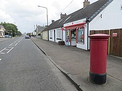
Stoneyburn is a village in West Lothian, Scotland. The village was the site of a large coalmine, since discontinued. Nearby towns include Bathgate, Whitburn, Addiewell and Blackburn. Around two thousand people inhabit the village (2022), which is around 1+1⁄2 miles (2.5 kilometres) in length, clustered around the B7015 to Fauldhouse and Livingston.

Scoonie
Scoonie is a settlement and parish in Fife, Scotland, the parish contains the town of Leven. It is bordered on the north by the parishes of Kettle and Ceres, on the east by the parish of Largo, on the south by the parishes of Markinch and Wemyss, and on the west by the parishes of Markinch and Kennoway. It extends about 4+1⁄2 miles (7.2 kilometres) north to south. Its width varies between 5⁄8 and 2+3⁄4 mi (1.0 and 4.4 km).
The parish is on the coast of the Firth of Forth, with a coastline of about 1+1⁄2 mi (2.4 km)
The area of the parish is 4,107 acres (1,662 hectares).
The River Leven forms the southern boundary of the parish, flowing into Largo Bay. The surface rises gradually northward to 600 feet (180 metres) near Kilmux Wood.
In 1951 the population of the parish was 9,518 and is now 9,613 (in 2011).
The population of the parish is mainly in Leven. In 1791 the parish population was 1,675, of which 1,165 were in the village of Leven. By 1901 Scoonie had a population of 6,342 of which 5,577 were in Leven. At the most recent census (2011) Scoonie has a population of 9,613, of which 9,004 are in Leven (94%).
The old parish church is now a ruin lying in the centre of the burial ground. It was constructed in the twelfth century and all that remains is a roofless structure which may have been the session house or vestry of the church.
The name Scoonie is of Gaelic and possibly Pictish origin meaning place of the lump-like hill. This refers to the site of the old kirk which was on a small hill like a mound.
Durie House lies in the centre of the parish. This mansion, built in 1762 as the seat of the Durie family, is now a listed building. On the northern borders of the parish are the historic estate of Montrave and the ruined castle of Aithernie, by the banks of Scoonie burn.

Great Rigg
Great Rigg is a fell in the English Lake District, 7 kilometres (4+1⁄4 miles) north-west of Ambleside and reaching a height of 766 metres (2,510 foot). It is most often climbed as part of the Fairfield horseshoe, a 16-km circular walk which starts and finishes in Ambleside. The fell's name originates from the Old English "Rigg", meaning a bumpy or knobbly ridge.

Ripon Cathedral
The Cathedral Church of St Peter and St Wilfrid, commonly known as Ripon Cathedral, and until 1836 known as Ripon Minster, is a cathedral in Ripon, North Yorkshire, England. Founded as a monastery by monks of the Irish tradition in the 660s, it was refounded as a Benedictine monastery by St Wilfrid in 672. The church became collegiate in the tenth century, and acted as a mother church within the large Diocese of York for the remainder of the Middle Ages. The present church is the fourth, and was built between the 13th and 16th centuries. In 1836 the church became the cathedral for the Diocese of Ripon. In 2014 the Diocese was incorporated into the new Diocese of Leeds, and the church became one of three co-equal cathedrals of the Bishop of Leeds.
The cathedral is notable architecturally for its gothic west front in the Early English style, considered one of the best of its type, as well as the Geometric east window. The seventh-century crypt of Wilfrid's church is a significant example of early Christian architecture in England. The cathedral has Grade I listed building status.

University Hospital Crosshouse
University Hospital Crosshouse, known locally as Crosshouse, is a large district general hospital situated outside the village of Crosshouse, two miles outside Kilmarnock town centre in Scotland. It provides services to the North Ayrshire and East Ayrshire areas and is managed by NHS Ayrshire and Arran.
Built to replace the former Kilmarnock Infirmary, it opened to patients in 1984, and today the hospital houses the national Cochlear Implant Service and provides paediatric inpatient services.

Joan Croft Halt railway station
Joan Croft Halt railway station was a small halt on the East Coast Main Line (ECML) situated by a level crossing at Joan Croft Junction in South Yorkshire, England. The junction gives access from the ECML to the Skellow line of the West Riding and Grimsby Railway and eventually to Hull, Immingham and Grimsby Docks.

35 The Shambles
35 The Shambles is a historic building in York, England. A Grade II* listed building, part of the structure dates to the mid-14th century, with an extension added the following century. The ground floor was rebuilt in variegated brick in Flemish bond; the two upper levels are rendered.
The building contains a priest-hole fireplace.

Heversham
Heversham is a village and civil parish in the Westmorland and Furness unitary authority area of Cumbria, England. In the 2001 census the parish had a population of 647, increasing at the 2011 census to 699.
It is situated above the marshes of the Kent estuary which gives some fine views, notably from Heversham Head where there is a toposcope.
It has a variety of recreational facilities, including a fully functioning outdoor activities centre, tennis courts, bowling green and a playground. There are also rugby, football and hockey fields, as well as a cricket ground and pavilion.

Church Street School swimming pool
The Church Street School swimming pool is a category C listed building in Glasgow, Scotland. It was built in 1904 as part of the redevelopment of the school by the local authority. The school closed in 1976 but the pool remained in use as a public facility until its closure in 1997. The building has remained unused since then, though the school now serves as offices for Glasgow City Council's health and social care team. The structure has fallen into disrepair and has been listed on the Buildings at Risk Register for Scotland since 1999. A redevelopment of the site is planned by the council.

All Saints Church, Siddington
All Saints Church is in the village of Siddington, Cheshire, England. The church is recorded in the National Heritage List for England as a designated Grade II* listed building. It is an active Anglican parish church in the diocese of Chester, the archdeaconry of Macclesfield and the deanery of Macclesfield. It is the Parish Church of Siddington with Capesthorne, which includes Holy Trinity, Capesthorne, and Christ Church, Eaton, and is part of the benefice of Marton, Siddington with Capesthorne and Eaton with Hulme Walfield.

Leppings Lane tram stop
Leppings Lane is a tram stop on the South Yorkshire Supertram network. It serves the surrounding areas of Wadsley, Wisewood, and Hillsborough around 3.4 km (2.1 mi) from the edge of Sheffield city centre. It is the last intermediate station on the Middlewood branch, opened on 23 October 1995. It is located on the A6102 road (Middlewood Road).

Rocksavage
Rocksavage or Rock Savage was an Elizabethan mansion in Cheshire, England, which served as the primary seat of the Savage family. The house lies in ruins, at SJ526799 in Clifton (now a district of Runcorn). Built in the 1560s for Sir John Savage, Rocksavage was one of the great Elizabethan houses of the county, a leading example of the Elizabethan prodigy house; in 1674, it was the second largest house in Cheshire. James I visited in 1617. The house was abandoned after it passed into the Cholmondeley family early in the 18th century, and by 1782 only ruins remained.
Rocksavage comprised a sandstone quadrangle around a central courtyard, with paired octagonal towers flanking the main entrance. Only fragments of its garden and orchard walls are still standing; they are listed as Grade II.

Dales Countryside Museum
The Dales Countryside Museum is a local museum for the Yorkshire Dales National Park in Northern England. Run by the National Park Authority, it tells the story of the people who have lived and worked in the Yorkshire Dales for over a 1,000 years. The basis of the museum was a collection of artefacts gathered by Marie Hartley, Ella Pontefract and Joan Ingilby.

Ireland's Cross
Ireland's Cross is a small hamlet in the civil parish of Woore in Shropshire, England.

Coalsnaughton
Coalsnaughton or Calabar (Scottish Gaelic: Caolas Neachdainn) is a village in Clackmannanshire, Scotland. It is just south of Tillicoultry of which it also lies in its parish. The miners' row was built by Robert Bald.

Ilex Mill
Ilex Mill is a cotton mill built in 1856 by Peter Whitehead in Rawtenstall, Lancashire. It reached its peak of production in 1895 when it had 50,000 spindles and 748 looms. However, by 1899 the building had been sold to Messrs Hoyle, Parker and Company who turned the premises into a shoe factory.
The building was once again used for textile production in the 1930s, and by 1954 two associated companies, James Rothwell and Fabricade Ltd occupied the building, working alongside one another. Fabricade made bed spreads and bathroom sets there until 1981, when they shut the plant down with the loss of 60 jobs. The building was put on the market for £85,000. The Council developed plans to turn the mill into a new Town Hall for the Borough of Rossendale which had been formed in 1974. The plans, which also involved the Rawtenstall Civic Society, the Lancashire Constabulary and the local Chamber of Commerce. They included Council administrative offices, a chamber for Council meetings and members facilities, as well as a police custody facilities, a community hall and tourist information office. The remaining space had yet to be allocated. The project received £4m from the Heritage Lottery Fund, English Heritage and English Partnerships. It was proposed that the renovation would be completed with minimum demolition and preservings as much as possible of the internal open space.
However these plans came to nothing, and after a brief period when the building was used to deliver training sessions, the building stood empty for 15 years. By 2003 the building was sold to PJ Livesey Living Space after two years of negotiation.

Gare Loch
The Gare Loch or Gareloch (Scottish Gaelic: An Gearr Loch) is an open sea loch in Argyll and Bute in the west of Scotland, and it bears a similar name to the village of Gairloch in the north west Highlands.
The loch is well used for recreational boating, water sports and fishing. Harbour and grey seals are often seen in the Gare Loch along with pods of porpoise. Bottle Nose whales were photographed in September 2020. The loch also has been used since the early 20th century for naval training and as a base for the United Kingdom's submarine based nuclear weapons system.