
 English
 Français

Elsdon (Northumberland)
Elsdon est une paroisse civile et un village du Northumberland, en Angleterre. La population de la paroisse civile au recensement de 2011 était de 242 habitants.
Nearby Places View Menu

6.1 km
Harwood Forest
Harwood Forest is a 3,527-hectare (8,720-acre) conifer plantation located to the south of Rothbury in North Northumberland, England, and managed by Forestry England.
The forest occupies moorland north of the east-west Morpeth to Elsdon road, west of the B6342, extending north to the Simonside Hills; it measures some eleven kilometres (6.8 mi) north-to-south and at its widest is seven kilometres (4.3 mi) east-to-west.
The initial impetus for its establishment was an offer made in 1929 by Sir Charles Trevelyan, 3rd Baronet to sell Harwood Farm to the commission at less than market rate. Trevelyan had inherited Wallington Hall and estate on the death of his father, the 2nd Baronet, in August 1928, and wished to see the estate forested; and although he determined on large-scale planting on other, retained, parts of the estate, he determined that it was reasonable to make arrangements with the commission to expedite his plan by transferring 1,536 acres (622 ha) to it. The farm forms the trapezoid southernmost section of the forest.
The next major acquisition was in 1950, when the Cragside estate of William Watson-Armstrong, 2nd Baron Armstrong, leased 525 acres (212 ha) to the commission, followed in 1951 by another 867 acres (351 ha), to form the Simonside section of the forest. This section is enclosed by the Simonside Hills, Simonside and Tosson Hill constraining the forest to a narrow neck-section, with additional forest to the north of Simonside.
In the same year, 1951, the County Borough of Tyneside leased Chartners, a 1,755-acre (710 ha) farm to the south of the Simonside section, which covered the high watershed of Fontburn Reservoir, to the commission. Subsequent additions to the forest include Redpath farm, which joined the previously isolated Harwood farm area to Chartners and the Simonside section.
8.5 km
Tosson Hill
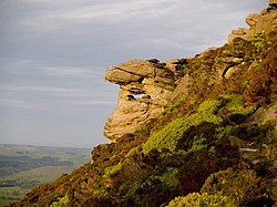
Tosson Hill is the highest hill in the Simonside Hills to the south of Rothbury in Northumberland, England. The summit lies about 2 kilometres (1.2 mi) west of Simonside, the best-known summit of the Simonside Hills. It has an elevation of 441.7 m (1,449 ft) and a prominence of 249.1 m (817 ft) and is classed as a Marilyn.
The summit is about 1 kilometre (0.62 mi) west of the edge of the Forestry Commission-owned Simonside Forest, and unlike the rest of the Simonside hills there was no public access to the summit. This has now changed, as the area is 'access land' under the terms of the Countryside and Rights of Way Act 2000.
The sandstone crags at Ravensheugh on the northern side of Tosson Hill offer a variety of short rock climbing routes, and have been described as "A superb crag on top quality sandstone." They are usually less busy than crags within the Simonside Forest.
8.7 km
Reivers Way
The Reivers Way is a long-distance footpath in Northumberland, passing through the Northumberland National Park and the Cheviot Hills. Totalling 242 kilometres (150 mi) it starts in the Roman township of Corbridge and crosses the Hexhamshire Common before heading up along Hadrians Wall. Via Wark and Rothbury it heads into the Cheviot range via Clennell Street leading up to The Cheviot before dropping down to Wooler. From Wooler the path passes through Belford to the Northumbrian Saxon's capital of Bamburgh, and then follows the Northumberland Coast Path through Seahouses to Alnmouth.
8.9 km
Holystone Burn Woods
Holystone Burn Woods is a Site of Special Scientific Interest (SSSI) within Northumberland National Park in Northumberland, England. It is located near the village of Holystone. The protected area includes part of the valley along which flows the stream called Holystone Burn. Part of the protected area is managed by the Northumberland Wildlife Trust.
9.4 km
Fallowlees Flush
Fallowlees Flush is the name given to a Site of Special Scientific Interest (SSSI) in mid-Northumberland, England. The steeply sloping site has calcium-rich springs supporting vegetation rare in the county.