
 English
 Français

Angleterre du Nord-Est
L'Angleterre du Nord-Est (North East England) est une des neuf régions d'Angleterre, au Royaume-Uni.
Elle comprend des comtés, districts et autorités du nord-est de l'Angleterre. Les administrations régionales sont regroupées à Newcastle upon Tyne. Sa superficie est de 8 592 km2 (8e région), sa population est de 2 597 000 habitants (recensement de 2011, 9e région) soit une densité de 302 hab./km2.
Nearby Places View Menu

213 m
North East England
North East England, often referred to as simply the North East within England, is one of nine official regions of England. It consists of County Durham, Northumberland, Tyne and Wear and part of North Yorkshire. With 2.6 million residents in 2022, it is the least populous region of England. Its largest settlements include Newcastle upon Tyne, Sunderland, Middlesbrough, Gateshead, Darlington and Hartlepool. The North East is covered by two mayoral combined authorities: North East Combined Authority and Tees Valley Combined Authority. It is one of three regions, the other two being North West England and Yorkshire and the Humber, that make up Northern England.
881 m
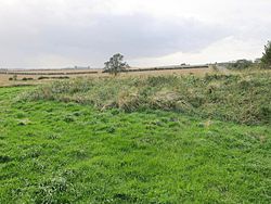
Milecastle 15
Milecastle 15 (Whitchester) was a milecastle of the Roman Hadrian's Wall. Its remains exist as a bold platform with robbed walls located on the southern side of the B6318 Military Road approximately 3 kilometres (1.9 mi) west of its crossing of the A69 road. It has not been excavated.

1.2 km
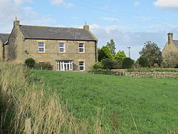
Horsley, Northumberland
Horsley is a small village and civil parish in Northumberland, England. The village lies on the top of a south-facing hill above the River Tyne, around 11 miles (18 km) from Newcastle upon Tyne and 12 miles (19 km) from Hexham.
Nearby villages include Heddon-on-the-Wall, Ovingham, Ovington and Wylam.

1.3 km
Harlow Hill, Northumberland
Harlow Hill is a small village in the civil parish of Stamfordham, in Northumberland, England.
Harlow Hill lies on the line of Hadrian's Wall, and is the site of Milecastle 16. The Military Road also passes by the village.
Harlow Hill was historically a township in the ancient parish of Ovingham. It became a separate civil parish in 1866. The civil parish was abolished on 1 April 1955, when it was merged with other parishes to create the civil parish of Stamfordham. In 1951 the parish had a population of 61.
1.3 km
Milecastle 16
Milecastle 16 (Harlow Hill) was a milecastle of the Roman Hadrian's Wall. The milecastle is located at Harlow Hill, Northumberland, England. There are no visible surface remains of the milecastle or either of its associated turrets.