
 English
 Français

For the reservoirs near Glossop, in Derbyshire, see Upper Swineshaw Reservoir and Swineshaw Reservoir (Derbyshire)
Higher Swineshaw Reservoir is the highest reservoir in a series of four in the Brushes valley above Stalybridge in Greater Manchester. It was built in the 19th century to provide a supply of safe drinking water. Though the reservoir and its watershed are totally in Greater Manchester it is within a mile of the Derbyshire border. It is owned and operated by United Utilities. The reservoir dam consists of a clay core within an earth embankment. The Peak District Boundary Walk runs across the dam on the south side of the reservoir.
Nearby Places View Menu

559 m
Lower Swineshaw Reservoir
Lower Swineshaw Reservoir is the second reservoir from the top of a series of four in the Brushes valley above Stalybridge in Greater Manchester. It was built in the 19th century to supply safe drinking water. It is owned and operated by United Utilities.
The reservoir dam consists of a clay core within an earth embankment.
1.0 km
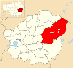
Stalybridge South (ward)
Stalybridge South is an electoral ward of Tameside, England. It is represented in Westminster by Jonathan Reynolds Labour Co-operative MP for Stalybridge and Hyde.

1.1 km
Harridge Pike
Harridge Pike is a hill situated within the boundaries of Stalybridge, Greater Manchester just outside the Peak District National Park. Its western flank rises from the valley of the River Tame to a height of 395 metres. To the east, the pike falls away more gradually to Swineshaw Moor which, above the Swineshaw reservoirs, rises to Irontongue Hill, a broad shoulder of Hoarstone Edge. Since 2004, the moorland in the area of the pike has been classed as access land. From the summit of Harridge Pike, a view is afforded of the middle section of the Tame valley and the whole of the town of Stalybridge, large swathes of the eastern suburbs of Manchester and beyond to Manchester city centre, where its town hall is visible. On exceptionally clear days the mountains of Snowdonia are visible.

2.0 km
Swallows Wood
Swallows Wood is a nature reserve near Hollingworth, Tameside, straddling the border between Greater Manchester and north Derbyshire. The 60-acre (0.24 km2) reserve, which contains semi-natural woodlands, meadows, ponds and marsh areas, is owned by United Utilities who are responsible for its management. The site was formerly occupied by the Hollingworth and Waste Lodge reservoirs; these were demolished in 1987, and the nature reserve was installed in their place. Arnfield Reservoir, the lowest of the Longdendale Chain reservoirs, is nearby.
The route of the proposed Longdendale Bypass would pass through the nature reserve and there is an ongoing campaign to save the wood. Although the bypass has been threatening the wood for nearly 30 years Tameside Council have recently committed to planting 10,000 managed trees, in an attempt to move the woodland gradually away from the bypass route.
The wood is on the fringes of the Peak District National Park; many walkers enjoy the area as the views over the woods and moorland are particularly impressive.