
 English
 Français

Phare d'Inchkeith
Le phare d'Inchkeith est un phare maritime construit sur l'île d'Inchkeith, dans l'estuaire de Firth of Forth dans l'ancien comté de Fife au sud-est de l'Écosse. C'est maintenant un monument classé du Royaume-Uni de catégorie A. Ce phare était géré par le Northern Lighthouse Board (NLB) à Édimbourg,l'organisation de l'aide maritime des côtes de l'Écosse. Il est maintenant sous l'autorité portuaire de Forth Ports (en).
Nearby Places View Menu
103 m
Inchkeith
Inchkeith (from the Scottish Gaelic: Innis Cheith) is an island in the Firth of Forth, Scotland, administratively part of the Fife council area.
Inchkeith has had a colourful history as a result of its proximity to Edinburgh, its strategic location for use as a home for Inchkeith Lighthouse, and for military purposes defending the Firth of Forth from attack from shipping and more recently protecting the upstream Forth Bridge and Rosyth Dockyard. Inchkeith has, by some accounts, been inhabited (intermittently) for almost 1,800 years.

3.9 km
Leith Roads
Leith Roads or Leith Road is a stretch of water off the coastal town of Leith, Scotland. The waters extend about two miles (3 km) offshore and provide a generally safe anchor, protected from the gales as they are, by Inchkeith.
It is located between Middle Bank (to the west of Inchkeith) and the coastline of Leith and Newhaven. The water depth is around 5 to 10 m (16 to 33 ft) at low tide. A designated small vessel anchorage and Lima Anchorage are marked on modern charts. Part of the area of Leith Roads was incorporated into the Outer Harbour of the Port of Leith, by the construction of breakwaters between 1936 and 1942.
The English landscape painter J. M. W. Turner drew a pair of sketches in 1822 entitled Shipping in Leith Roads which are part of the Tate's collection.
On 21 October 1875 the Schooner Lindisfarne jettisoned about 30 tonnes of coal in the Leith Roads after suffering damage to the tiller and other slight damage.

4.6 km
Kinghorn Lifeboat Station
Kinghorn Lifeboat Station is located at St James Place, Kinghorn, a town and seaside resort on the northern shore of the Firth of Forth, on the Fife peninsula, on the east coast of Scotland.
A lifeboat station was established at Kinghorn by the Royal National Lifeboat Institution (RNLI) on 26 June 1965.
The station currently operates a B-class (Atlantic 85) Inshore lifeboat, Tommy Niven (B-836), on station since 2009.
4.6 km
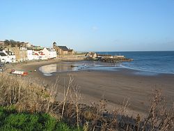
Kinghorn
Kinghorn ( ; Scottish Gaelic: Ceann Gronna) is a town and parish in Fife, Scotland. A seaside resort with two beaches, Kinghorn Beach and Pettycur Bay, plus a fishing port, it stands on the north shore of the Firth of Forth, opposite Edinburgh.
Known as the place where King Alexander III of Scotland died, it lies on the A921 road and the Fife Coastal Path. Kinghorn railway station is on the Edinburgh to Aberdeen and Fife Circle railway lines. Kinghorn only has a primary school, so high school pupils must travel by bus to Balwearie High School in Kirkcaldy. The neighbouring parish of Burntisland was in the past referred to as Little Kinghorn or Wester Kinghorn.
Kinghorn Lifeboat Station is one of Scotland's busiest – regularly getting called out to all sorts of emergencies in the Firth. Currently stationed at Kinghorn is an Atlantic 85 inshore lifeboat, B-836 "Tommy Niven".
The civil parish has a population of 4,201 (in 2011). According to the 2008 population estimate, the town has a population of 2,930.

4.6 km
Kinghorn railway station
Kinghorn railway station is a railway station in the town of Kinghorn, Fife, Scotland. The station is managed by ScotRail and is on the Fife Circle Line, 22+3⁄4 miles (36.6 km) north east of Edinburgh Waverley.