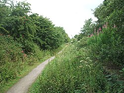
Marton is a hamlet in the civil parish of Burton Constable, in the East Riding of Yorkshire, England, and in an area known as Holderness. It is situated approximately 8 miles (13 km) north-east of Kingston upon Hull city centre and 2 miles (3.2 km) east of the village of Skirlaugh and the A165 road. Marton was formerly a township in the parish of Swine, in 1866 Marton became a separate civil parish, on 1 April 1935 the parish was abolished and merged with Burton Constable. In 1931 the parish had a population of 73. In 1823 Marton was in the Wapentake and Liberty of Holderness. A Catholic chapel was the only place of worship. Population at the time was 129, with occupations including nine farmers and a shoemaker. A carrier, who was also a Licensed victualler, operated between the village and Hull twice weekly. Marton was served from 1864 to 1964 by Burton Constable railway station on the Hull and Hornsea Railway. To the south-east of the settlement is the Roman Catholic Church of the Holy Sacrament which is a Grade II listed building. The name Marton derives from the Old English meretūn meaning 'mere settlement'.

1. References


1. External links

Media related to Marton at Wikimedia Commons Marton in the Domesday Book

Nearby Places View Menu
Location Image
1.0 km

Burton Constable railway station

Burton Constable railway station was a railway station which served the villages of Marton and Burton Constable in the East Riding of Yorkshire, England. It was on the Hull and Hornsea Railway. It opened on 28 March 1864 as "Marton", but was renamed "Burton Constable" on 1 August 1864, to avoid confusion with various other Martons elsewhere. It was renamed again (to avoid confusion with Constable Burton on the Wensleydale Railway), on 1 January 1922 and became known as "Ellerby". It closed following the Beeching Report on 19 October 1964.
Location Image
1.1 km

New Ellerby

New Ellerby is a hamlet in the East Riding of Yorkshire, England, in an area known as Holderness. It is situated approximately 8 miles (13 km) north-east of Hull city centre and 1.5 miles (2.4 km) east of Skirlaugh, lying to the east of the A165 road. Together with its neighbour, Old Ellerby, it forms the civil parish of Ellerby. In 1823, Edward Baines indicates Ellerby was in the civil parish of Swine, and the Wapentake and Liberty of Holderness. The population at the time, including the then settlements of Dowthorp, Langthorp and Owbrough, was 233, including five farmers, a blacksmith, a wheelwright, a shoemaker, the landlord of The Board public house, and a further farmer at Dowthorp. New Ellerby was served from 1864 to 1964 by Burton Constable railway station on the Hull and Hornsea Railway. The name Ellerby derives from the Old English personal name Aelfweard and the Old Norse bȳ meaning 'village'.
Location Image
1.4 km

Holderness Wapentake

Holderness was a wapentake of the historic East Riding of Yorkshire, England consisting of the south-easterly part of the county. Established in medieval times, it ceased to have much significance in the 19th century when the wapentakes were superseded by other administrative divisions for most local government purposes. Because of its large area it was sub-divided into three divisions—North Division, Middle Division and South Division.
Location Image
1.6 km

Ellerby, East Riding of Yorkshire

Ellerby is a civil parish in the East Riding of Yorkshire, England. It is situated 8 miles (13 km) to the north-east of Hull city centre and covering an area of 924.853 hectares (2,285.36 acres). The civil parish is formed by the hamlets of New Ellerby and Old Ellerby. According to the 2011 UK census, Ellerby parish had a population of 365, a decrease on the 2001 UK census figure of 393. In 2020 the Ellerby Area Hoard was found during building renovations in a house in Ellerby parish. It is a hoard of 266 17th-18th century gold coins found in a stoneware vessel.