
 English
 Français

Sheepwash (Northumberland)
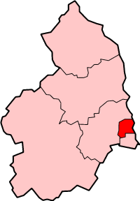
Sheepwash est une ancienne paroisse civile et un village du Northumberland, en Angleterre.
1. Notes et références
(en) Cet article est partiellement ou en totalité issu de l’article de Wikipédia en anglais intitulé « Sheepwash, Northumberland » (voir la liste des auteurs).
1. Liens externes
Portail de l’Angleterre
Nearby Places View Menu

340 m
Sheepwash, Northumberland
Sheepwash is a village and former civil parish, now in the parish of Ashington, in the county of Northumberland, England. It is adjacent to Stakeford and Guide Post and across the River Wansbeck from Ashington. In 1931 the parish had a population of 68.

807 m
Northumberland Coalfield
The Northumberland Coalfield is a coalfield in north-east England. It is continuous with the Durham Coalfield to its south. It extends from Shilbottle in the north to the boundary with County Durham along the River Tyne in the south, beyond which is the Durham Coalfield.
The two contiguous coalfield areas were often referred to as the Durham and Northumberland Coalfield(s) or as the Great Northern Coalfield.
819 m
Guide Post
Guide Post (also referred to as Guidepost) is a village in South East Northumberland, England, about 17 miles (27 km) north of Newcastle upon Tyne. It lies south of the River Wansbeck along with Stakeford (with whom it shares an undefined boundary). It is part of the civil parish of Choppington.
Guide Post is mainly a residential village. There are two pubs, The Anglers Arms and The Shakespeare Tavern, and a Social Club. It has several shops and three schools; Cleaswell Hill, Mowbray Primary and Ringway Primary.
950 m
Stakeford
Stakeford is a large village in south east Northumberland, England.
Its about 17 miles (27 km) north of Newcastle upon Tyne. It lies south of the River Wansbeck from Ashington, the nearest town. The village takes its name from the former river crossing to the north of the village, this was a crossing through the mudflats which was marked with stakes to give an idea of the water depth, hence the name Stakeford. The river crossing has long gone, but remains of the stakes can be seen in the river bed becoming visible whenever the dam downstream is opened. The old river crossing was replaced by a bridge in the early 20th century, which in itself was replaced by the new Stakeford Bridge in 1994. There is now no trace of the original ford due to the mudflats being used as a landfill site in the 1950s and 60s and the creation of a riverside country park in the 1970s.
It is a mainly residential village. There are three pubs and a Social Club. There is also a miners' institute although it never had a mine as this was located in the adjacent village of Bomarsund. Stakeford has several shops and a primary school. Today Stakeford forms one built-up area, with neighbouring Guide Post and Sheepwash.
1.7 km
Wansbeck District
Wansbeck was a local government district in south-east Northumberland, England. Its main population centres were Ashington, Bedlington and Newbiggin-by-the-Sea.
The area which was bounded by the district is mostly urban, on the North Sea coast north of the Tyneside conurbation. It bordered Blyth Valley district to the south, the border being the River Blyth. It was formed on 1 April 1974, under the Local Government Act 1972, by the merger of the urban districts of Ashington, Bedlingtonshire and Newbiggin-by-the-Sea. It is named after the River Wansbeck.
The district council was abolished as part of the 2009 structural changes to local government in England effective from 1 April 2009 with responsibilities being transferred to Northumberland County Council, a unitary authority.