
 English
 Français

Steel Fell
Steel Fell is a fell in the English Lake District, lying between Thirlmere and Grasmere. It is triangular in plan, the ridges running north, west and south east. Steel Fell rises to the west of the Dunmail Raise road and can be climbed from the summit, or from Grasmere and Wythburn.
Nearby Places View Menu
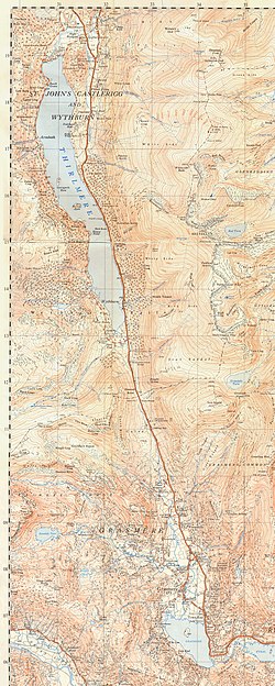
944 m
Dunmail Raise
Dunmail Raise is the name of a large cairn in the English Lake District, which may have been an old boundary marker. It has given its name to the mountain pass of Dunmail Raise, on which it stands. This mountain pass forms part of the only low-level route through the mountains between the northern and southern sides of the Lake District. According to local tradition, the cairn marked the burial of a king named Dunmail who was slain by Saxons. The place name itself may well be derived from the name of the historical Dyfnwal ab Owain, King of Strathclyde.

956 m
A591 road
The A591 is a major road in Cumbria, which lies almost entirely within the Lake District national park. A 2009 poll by satellite navigation firm Garmin named the stretch of the road between Windermere and Keswick as the most popular road in Britain. The 29.8 mile stretch between Kendal and Keswick was also named the UK's best driving road, according to a specially devised driving ratio formulated by car rental firm Avis.
1.3 km
Gibson Knott
Gibson Knott is a fell in the English Lake District, an intermediate height on the ridge between Greenburn and Far Easedale in the Central Fells.

1.4 km
River Rothay
The Rothay is a spate river of the Lake District in north-west England. Its name comes from Old Norse and translates literally as the red one. This has come to mean trout river. It rises close to Rough Crag above Dunmail Raise at a point about 1542 feet (470 m) above sea level (grid reference NY306108). Its catchment area covers Grasmere Common including Easedale Tarn, the southern flanks of Fairfield, and several of the fells to the east of Dunmail Raise, including Great Rigg, Rydal Fell, Scandale Fell and Heron Pike.
From its source the Rothay descends through the valley of Greenburn Bottom to the hamlet of Helmside not far from the main A591 road over Dunmail Raise. Just north of the village of Grasmere the river subsumes Easedale Gill and Sour Milk Gill, the latter flowing out of Easedale Tarn. In the village the river flows close to the churchyard where the poet Wordsworth is buried. The Rothay then flows into the head of the lake of Grasmere (elevation 208 feet/63 m). As well as replenishing Grasmere, the Rothay also drains it, flowing for just half a mile (800 m) from the southern end of the lake before replenishing Rydal Water (elevation 181 feet/55 m) at its western extremity. The Rothay drains Rydal from its easternmost point and then flows in a general southerly direction for about three miles (4.8 km) before merging with the River Brathay at Croft Lodge south-west of Ambleside. From there the rivers flow into the northern end of Windermere. In addition to those tributaries already noted, several others are subsumed by the Rothay.
About a mile (1.6 km) north of Ambleside the Rothay is crossed by a well-known set of stepping stones. Several sections of the Rothay are popular with canoeists, including the section between Grasmere and Rydal; the river is graded as 2+. The Rothay is a trout fishery where brown trout can be caught. Anglers should enquire locally about licences (an Environment Agency Rod Licence is required).
The River Rothay is wholly within the historic county of Westmorland. After local government reorganisation in 1974 the river was in the administrative county of Cumbria. Following further local government reorganisation in 2023 the river flows within the council area administered by Westmorland and Furness Council.