
 English
 Français
Great Strickland
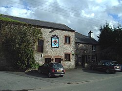
Great Strickland is a village and civil parish in the Eden Valley between the Cumbrian mountains in the west and the Pennines in the east. It is 5 miles (8.0 km) south east of Penrith, and is in the former county of Westmorland. At the 2011 Census Great Strickland was grouped with Little Strickland, itself enlarged to include Thrimby after 2001, to give a total population of 370. The equivalent figure from the 2001 census was 342. The sandstone village church is dedicated to Saint Barnabas and was constructed in 1872. It has a bell turret. To the west of the village lies the River Leith, the West Coast Main Line and the M6 Motorway. To the south lies the small settlement of Little Strickland.
Nearby Places View Menu
1.2 km
Leath
Leath was one of the wards of the historic county of Cumberland in north west England. Unlike most other English counties, Cumberland was divided into wards rather than hundreds.
The ward was bounded on the south by Westmorland, the north by Cumberland and Eskdale wards, the east by the counties of Northumberland and Durham and on the west by the wards of Allerdale above Derwent and Allerdale below Derwent.
In the Imperial Gazetteer of England and Wales (1870–72) John Marius Wilson described Leath:
LEATH, a ward in Cumberland; bounded by Northumberland, Durham, and Westmoreland, and by the wards of Eskdale and Allerdale; and containing Addingham parish, twenty other parishes, and part of another. Acres, 216,296. Pop. in 1851, 29,103; in 1861, 28,675. Houses, 5,819.
The ward largely corresponds to that part of the modern Eden District that lies within Cumberland that is the former Penrith urban and rural districts and the Alston with Garrigill Rural District.
Market towns in the ward were Penrith (the largest settlement and seat of local government), Kirkoswald and Alston. At one time, the village of Greystoke had held markets.
A large part of the ward once made up the main part of the Royal hunting ground known as Inglewood Forest, which was subject to Forest Laws up until the reign of Henry VIII.
The manors of Penrith, Langwathby, Castle Sowerby and Great Salkeld and at times Glassonby and Gamblesby were part of the royal estate known as the Honour of Penrith, which eventually passed into the hands of the Dukes of Devonshire.

1.5 km
Hackthorpe
Hackthorpe is a hamlet in Westmorland and Furness, in the county of Cumbria, England. Circa 1870, it had a population of 110 as recorded in the Imperial Gazetteer of England and Wales.

2.4 km
Melkinthorpe
Melkinthorpe is a hamlet in the civil parish of Lowther, in the Westmorland and Furness district, in the county of Cumbria, England. It is near the villages of Hackthorpe and Cliburn. Circa 1870, it had a population of 99 as recorded in the Imperial Gazetteer of England and Wales.

2.4 km
Thrimby
Thrimby is a hamlet and former civil parish, now in the parish of Little Strickland, in Westmorland and Furness, Cumbria, England. In 2001 the population of the civil parish of Thrimby was 30. The population measured at the 2011 Census was less than 100. Details are included in the parish of Great Strickland. It has a Grade 2* farmhouse called Thrimby Hall, as seen in series 4 of the BBC Two fly-on-the-wall farming documentary "This Farming Life".