
 English
 Français

Bourouba
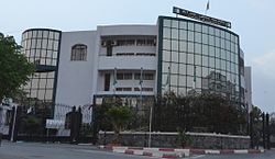
Bourouba est une commune de la wilaya d'Alger en Algérie, située dans la proche banlieue Sud-Est d'Alger.
1. Géographie


1. = Situation =
Bourouba est située à environ 10 km au sud-est d'Alger.
1. = Transports =
La commune de Bourouba dispose d'une gare routière ainsi que de plusieurs stations de métros (Bachdjarah Tennis, Bachdjarah) permettant l'accès facile à plusieurs communes avoisinante (Aïn Naâdja, El Harrach) ainsi qu'au centre-ville d'Alger.
1. Histoire
La commune de Bourouba a été créée en 1984 à partir de quartiers faisant partie auparavant de la commune d'El Harrach.
1. Démographie


1. Urbanisme
Les principaux quartier de Bourouba sont : Les cités PLM, La Faïence, L’Urgence, Diar El Afia, El Istiqlal, Vidal, Dussolier, Boubsila, Haï El Djebel (La Montagne), Sainte Corinne, La Prise d'Eau, Egeco, Eucalyptus, La CNEP, Ben Boulaid, Cité Chahid Hadji Moussa.
1. Éducation
La commune compte 32 établissements publics avec 20 écoles primaires, 9 collèges d'enseignement moyen (CEM) et 3 lycées.
9 Collèges d'enseignement moyen public (CEM)
3 Lycées publics
1. Sport
Le quartier de Haï El Djebel est représenté par une équipe de football : le Jil Saad de Haï El Djebel (JSHD) qui a évolué en troisième division algérienne lors de la saison 2014-2015.
1. Notes et références
Portail d'Alger Portail des communes d'Algérie
Nearby Places View Menu
Bachdjerrah
