
 English
 Français

Ashton upon Mersey
Ashton upon Mersey is an area in Trafford, in Greater Manchester, England. It lies on the south bank of the River Mersey, 5 miles (8.0 km) south of Manchester city centre and immediately adjoins Sale to the east. It gives its name to the Ashton upon Mersey ward, which covers the main part of the former village. Ashton upon Mersey lies within the historic county boundaries of Cheshire, and became part of Greater Manchester in 1974.
Nearby Places View Menu

727 m
St Martin's Church, Ashton upon Mersey
St Martin's Church is in Church Lane, Ashton upon Mersey, a district of Sale, Greater Manchester, England. It is recorded in the National Heritage List for England as a designated Grade II* listed building. It is an active Anglican parish church in the diocese of Chester, the archdeaconry of Macclesfield and the deanery of Bowdon.

960 m
A6144(M) motorway
The A6144(M) was a motorway in Carrington, Greater Manchester, England. It was known in official documentation as the Carrington Spur Road and built to facilitate the transport of hazardous goods from Shell Chemicals' ethylene oxide plant in Carrington and other industrial estates in Carrington and Broadheath. It was extremely unusual in that it was entirely single carriageway, the only motorway of its kind in the UK as others were dual carriageway for at least some of their length.
About 1 mile (2 km) long, the road connected the A6144 road to the M60 at junction 8. It was the highest numbered A-road(M) motorway and one of only three four-digit, Axxxx(M) motorways, the others being the A6127(M) (now A167(M)) and the temporary A1077(M). The motorway was not a trunk road and not the responsibility of the Highways Agency.
The road had no hard shoulder but two emergency lay-bys with SOS phones and lights were provided midway along its length. A reason for its motorway status was that the junction with the M60 had two small roundabouts that were difficult for a driver of a long vehicle prohibited from motorways to perform a U-turn because of their size.
The unusual status of the A6144(M) led to it gaining a number of fans, particularly within organisations such as the Society for All British And Irish Road Enthusiasts (SABRE).
1.0 km
Chartered Institution of Civil Engineering Surveyors
The Chartered Institution of Civil Engineering Surveyors or CICES is a professional association in the field of civil engineering surveying, headquartered in the United Kingdom. CICES members consist mainly of commercial managers, quantity surveyors, and geospatial engineers working and studying within civil engineering surveying. The institution began in 1969 as the Association of Surveyors in Civil Engineering, became a registered educational charity in 1992, and received a royal charter in 2009.
1.1 km
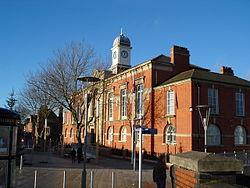
Municipal Borough of Sale
Sale was, from 1867 to 1974, a district in Cheshire, England. The district had in turn the status of local government district, urban district and municipal borough. Its area now forms part of the Metropolitan Borough of Trafford, Greater Manchester.