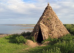
Craster est un petit village de pêcheurs sur la côte de du comté de Northumberland en Angleterre. Il possède un petit port et offre une vue vers le nord le long de la côte rocheuse jusqu'aux ruines du château de Dunstanburgh. C'est le point d'accès le plus proche du château et l'approche doit être faite à pied car il n'y a qu'un chemin herbeux. Le village suivant vers le nord est Embleton. Pendant de nombreuses années, le village a eu une activité économique liée aux hareng. Les Craster kipper (en) sont des sandwichs bien connus en Angleterre. Les harengs locaux sont fumés de façon traditionnelle par la famille Robson. Les vestiges d'une tour au bout du port sont tout ce qu'on peut voir maintenant d'un bâtiment beaucoup plus grand qui faisait partie des équipements qui servaient au transport de la pierre locale vers les bateaux dans le port. La carrière désaffectée est maintenant un parking. À une petite distance à l'intérieur des terres, se trouve la tour de Craster (en), la demeure de la famille Craster qui possédait la carrière et qui a fait fortune avec la carrière. Un mémorial sur le mur du port commémore un membre de cette famille qui est mort en service au service de l'armée britannique au Tibet au XIXe siècle. La promenade le long de la côte au sud passe par Cullernose Point, un exemple des falaises basaltiques qui sont une caractéristique importante du paysage local. La côte du Nrothumberland fait partie des Area of Outstanding Natural Beauty. À un mile à l'ouest, Dunstan Hall est un manoir qui incorpore une peel tower, maintenant utilisée comme logement de vacances.

1. Source de la traduction

(en) Cet article est partiellement ou en totalité issu de l’article de Wikipédia en anglais intitulé « Craster » (voir la liste des auteurs). Portail de l’Angleterre

Nearby Places View Menu
Location Image
0 m

Craster

Craster is a small fishing village on the Northumberland coast of England, eight miles (13 km) from Alnwick. The next village to the north is Embleton. It is within the Northumberland Coast Area of Outstanding Natural Beauty.
Location Image
146 m

Craster Lifeboat Station

Craster Lifeboat Station is located at West End, in the small harbour village of Craster, situated mid-way between Seahouses and Amble, on the coast of Northumberland, England. An Inshore lifeboat was first stationed in Craster by the Royal National Lifeboat Institution (RNLI) in August 1969. The station currently operates a D-class (IB1) Inshore lifeboat, Skpr James Ballard RNVR DSC (D-839), on station since 2019.
214 m

Craster Tower

Craster Tower is an 18th-century Georgian mansion incorporating a 14th-century pele tower situated near the fishing village of Craster, Northumberland, England. It is a Grade II* listed building.
Location Image
488 m

Craster radar station

Craster radar station (also known as RAF Craster), was a Chain Home Low (later a Chain Home Extra Low) Second World War radar site at Craster in Northumberland, England. The radar site is north of the village of Craster on an escarpment overlooking the North Sea. The site was opened by early 1942 and was staffed initially by the British Army, but later came under the control of No. 73 Wing of the Royal Air Force, part of No. 60 Group. It closed in 1944 and was later used as a PoW camp.
Location Image
2.0 km

Howick house

The Howick house is a Mesolithic site located in Northumberland, England. It was found when an amateur archaeologist noticed flint tools eroding out of a sandy cliff face near the village of Howick. Investigations found a circle of substantial post holes with charcoal stains in their bases, a number of smaller stake holes, some angled in from outside a hollow, and inside the house a number of shallow hearths filled with charcoal, burnt nutshells and some fragments of bone. Radiocarbon dating of the charred hazelnut shells established that the building was constructed about 7600 BC and occupied for about 100 years, which led to the find being called "Britain's oldest house". This title was disputed in 2010 when the discovery of the even older 'house-structure' at Star Carr in North Yorkshire was announced. Some of the hearths showed signs only of nut roasting, and the numbers of shells suggested that food was cooked here in quantity, perhaps to preserve it for times of scarcity. Together with the very substantial construction shown by the size of post holes, this led to the view that the house was occupied permanently rather than being used on a transient or seasonal basis as expected during the Mesolithic period. Charred hazelnut shells have been found at several other sites from this period, including Cramond, but their smaller stake holes were interpreted as remains of a temporary encampment. The interpretation that this was a permanent residence for hunter-gatherers is supported by analysis that Howick is a place where natural resources would have allowed all-year-round occupation. Its coastal position provided animals, flint for tools, wood for construction and fuel, fish, seals, sea birds and their eggs, shellfish and a nearby source of fresh water that was available at the time of occupation. Many sites from this time are coastal, but the particular circumstances found here and the evidence of ceremonial ritual from the site at Star Carr in Yorkshire, only 100 miles away, are interpreted as indicating that Mesolithic hunter-gatherers were capable of establishing permanent settlements.