
 English
 Français

Mappleton
Mappleton est une paroisse civile et un village du Yorkshire de l'Est, en Angleterre.
1. Notes et références
(en) Cet article est partiellement ou en totalité issu de l’article de Wikipédia en anglais intitulé « Mappleton » (voir la liste des auteurs).
1. Liens externes
Ressource relative à la géographie : Open Domesday
Portail du Yorkshire
Nearby Places View Menu
0 m
Mappleton
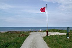
Mappleton is a village and civil parish in the East Riding of Yorkshire, England. It is situated on the North Sea coastline in an area known as Holderness, lying approximately 3 miles (5 km) south of the seaside resort of Hornsea.
The civil parish is formed by the village of Mappleton and the hamlets of Cowden, Great Cowden and Rolston.
According to the 2011 UK census, Mappleton parish had a population of 342, an increase on the 2001 UK census figure of 249.
The parish church of All Saints is a Grade II* listed building.

1.3 km
Great Cowden
Great Cowden is a hamlet in the civil parish of Mappleton, in the East Riding of Yorkshire, England, in an area known as Holderness. It is situated approximately 3 miles (5 km) south of Hornsea and lies just east of the B1242 road on the North Sea coast.
The name Cowden derives from the Old English coldūn meaning 'coal hill'.
In 1823 Cowden (as Great and Little Cowden) was also known as 'Coldon', and was in the parish of Mappleton. The parish incumbent's living was under the patronage of the King, although at the time the parish church had been swallowed by the sea. Population was 146, with occupations including eleven farmers.

1.7 km
Rolston
Rolston is a hamlet in the East Riding of Yorkshire, England, in an area known as Holderness. It is situated approximately 2 miles (3.2 km) south of Hornsea and lies just west of the B1242 road.
It forms part of the civil parish of Mappleton.
The name Rolston derives from the Old Norse personal name Rolf and the Old English tūn meaning 'settlement'.
3.7 km
RAF Cowden
RAF Cowden was a Royal Air Force bombing range, near to the village of Aldbrough, East Riding of Yorkshire, England. The site was used by the RAF and other air forces between 1959 and 1998, though the land part of the site was used by the army for training in the Second World War. Since closure, explosive ordnance disposal (EOD) teams have had to visit the site on numerous occasions due to erosion of the cliffs by the North Sea revealing old practise bombs.

3.7 km
Wassand railway station
Wassand railway station was a railway station that served the villages of Wassand and Goxhill in the East Riding of Yorkshire, England. It was on the Hull and Hornsea Railway.
It opened in 1865, and was originally named "Goxhill". It was renamed "Wassand" (to avoid confusion with Goxhill in Lincolnshire) on 1 October 1904, and closed on 21 September 1953.