
 English
 Français

Paull est un village côtier et une paroisse civile du Holderness, dans le Yorkshire du Nord en Angleterre. Il est situé sur la rive nord du grand estuaire du Humber, à environ 10 km à l'est de Kingston-upon-Hull. Le village de Paull est le seul village d'importance de la paroisse, à l'exclusion des fermes isolées. Il possède une église, une école, un phare des trois pubs. Anciennement, Paull possédait un chantier naval et a construit des unités pour la Royal Navy jusqu'en 1830. Il a aussi été un petit port de pêche pour la crevette. Touristiquement Paull possède une vieille église, l'église Saint Andrew construite en 1355. Le long de la Humber on trouve aussi des anciennes fortifications de défense côtière du XVIe siècle.
Nearby Places View Menu

0 m
Paull
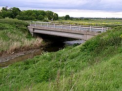
Paull (archaic Paul, Pall, Pawle, Pawel, Paulle, Paghel, Paghill, Paghil, Pagula) is a village and civil parish in Holderness, in the East Riding of Yorkshire, England, lying on the north bank of the Humber Estuary, east of the watercourse known as Hedon Haven.
The village is situated approximately 6 miles (10 km) east of Kingston upon Hull.

720 m
Fort Paull
Fort Paull is a gun battery situated on the north bank of the Humber, near the village of Paull, downstream from Hull in northern England.
926 m
Hedon Haven
Hedon Haven is a waterway that connected the Humber Estuary with the port of Hedon, in Holderness, East Riding of Yorkshire, England. The waterway allowed ships to unload at the port in Hedon, which was also known as Hedon Haven and had, at its peak, three canalised arms that stretched into the town. The port at Hedon was the main port for south Holderness between the 12th and 13th centuries, and was the busiest port in Holderness before the docks at Hull were built.
The port suffered several downturns in business, first with the siltation of the waterways, then being eclipsed by the newer docks at Hull. Later with the building of the turnpike road through Hedon, and when the railway connecting Hull with Withernsea was opened, port traffic went into a decline. After the waterway kept silting up, the decision was taken in the 1970s to abandon the haven and fill parts of it in. Large swathes encircling the town are designated as a scheduled monument, including the previous areas of canalised waterways, whilst the main area of the haven to the south of the town, is designated as a conservation area.
The western end of Hedon Haven still exists as an outfall into the Humber Estuary, and this watercourse is fed by the Burstwick Drain (Humbleton Beck) and other smaller becks and stream. Ordnance Survey (OS) mapping shows Hedon Haven starting just west of the town of Hedon, whereas the county council state that the term Hedon Haven only applies to the watercourse in its tidal reach. In antiquity, the river feeding the watercourse was known as the River Hedon and the Haven, was the canalised sections around the town of Hedon used as port facilities.
A plan that was formulated in the 21st century, has proposed the revival of the haven as a pleasure waterway with a marina and a country park located at the southern end of Hedon.
2.1 km
Humber Gas Tunnel
The Humber Gas Tunnel is a natural gas-carrying pipeline that runs underneath the Humber Estuary between Paull in the East Riding of Yorkshire, and Goxhill in Lincolnshire, England. The project was started in April 2018, and the pipeline was used to transport gas for the first time in December 2020. It is designed to carry 20% of the gas used in the United Kingdom, and is a crucial feeder pipeline to carry gas to the south of England. It is the longest pipe in a tunnel in Europe, and due to being inserted into the tunnel that was deliberately flooded with water, it is the longest hydraulically inserted gas pipeline in the world.

2.3 km
Paull Holme Tower
Paull Holme Tower is an unusual late-medieval fortified tower in the East Riding of Yorkshire, England.