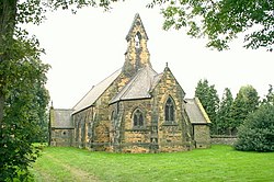
Whitley Preceptory was a priory in North Yorkshire, England. The site of the priory is thought to have been located 0.62 miles (1 km) south west of the village of Whitley and was one of twelve run by the Knights Templar in Yorkshire alone. Whilst the exact location of the manor house is unknown, the presence of a moat at grid reference SE555205, is thought to indicate the possible location of the priory. It is known to have been in the possession of the Templars by 1248, but was probably in use before that time. Sometime between 1308 and 1312, the preceptory was abandoned after the suppression of the Knights Templar. As the site cannot be positively identified, some have suggested the manor was in Weedley, a deserted medieval village in the East Riding of Yorkshire.

1. References
Nearby Places View Menu
Location Image
916 m

Whitley, North Yorkshire

Whitley is a village in North Yorkshire, England, close to the Aire and Calder Navigation and the M62 motorway. The population of the village at the 2001 census was recorded as being 574, which had risen to 1,021 by the time of the 2011 census. In 2015, North Yorkshire County Council estimated the population to have risen again to 1,110. It was historically part of the West Riding of Yorkshire until 1974. From 1974 to 2023 it was part of the district of Selby, it is now administered by the unitary North Yorkshire Council.
Location Image
2.3 km

Whitley Bridge railway station

Whitley Bridge railway station serves the villages of Eggborough and Whitley in North Yorkshire, England. It is located on the Pontefract Line and is 20 miles (32 km) east of Leeds. It was opened by the Lancashire and Yorkshire Railway on 1 April 1848, on their line between Wakefield Kirkgate and Goole via Knottingley.
Location Image
2.4 km

Womersley railway station

Womersley railway station served the village of Womersley, in North Yorkshire, England, between 1848 and 1948.
Location Image
2.8 km

Womersley

Womersley is a village and civil parish in North Yorkshire, England. In 2001 the parish had a population of 363. The parish population at the 2011 census (including Stapleton and Walden Stubbs) was 515. It is near the towns of Selby, Askern and Pontefract. It is close to the borders with South and West Yorkshire. The village was part of the West Riding of Yorkshire until 1974. From 1974 to 2023 it was part of the district of Selby, it is now administered by the unitary North Yorkshire Council. The name Womersley derives from the Old English Wilmaerslēah meaning 'Wilmaer's wood/clearing'.