
 English
 Français

Affetside
Affetside is a village in Greater Manchester, England. Historically in Lancashire, it is in the Tottington ward of Bury Metropolitan Borough Council and the Bury North parliamentary constituency, in the West Pennine Moors.
Nearby Places View Menu

1.3 km
Hawkshaw, Greater Manchester
Hawkshaw is a village in the Metropolitan Borough of Bury, in Greater Manchester, England. Historically a part of Lancashire, it has a population of around 1,000 people. The village had a small shop which is now closed and 2 pubs called The Red Lion and The Waggon and Horses.
On the A676, west of Greenmount, the road changes its name from Bolton Road to Ramsbottom Road after it crosses Kirklees Brook.
The village school is called St Mary's Church of England Primary School. It currently educates around 100 pupils and employs 6 teachers. The school is also connected to St Mary's Church, which is also Church of England.
There is a large playing field known to the locals as "the rec". There is a large football pitch, which is currently unused. The children's play area has both adult and toddler swings, a large slide, rocking chairs, and roundabout and a see-saw. The park is enclosed by a low fence. At the end of "the rec", there is a large tennis club, with a club house and 5 tennis courts, 3 of which are under flood-lights.
Hawkshaw has an Army Training Camp used as the HQ of the Greater Manchester Army Cadet Force. The adjoining Holcombe Ranges is one of the shooting ranges in the United Kingdom. The Physical Ability round of The Krypton Factor was filmed at the base's Assault Course on Holcombe Moor, north of Hawkshaw.
The A676 road passes through Hawkshaw.

1.4 km
Kirklees Brook
Kirklees Brook is a minor river in Greater Manchester, England. It is 6.56 miles (10.556 km) long and including tributaries has a catchment area of 5.23 square miles (13.547 km2).
Kirklees Brook springs from the slopes of Holcombe Moor at Grainings on the modern boundary with Lancashire, north of Hawkshaw, flowing south. At Brookhouse Mill between Greenmount and Tottington there are a number of small connected reservoirs. It is known as Woodhill Brook for a short stretch before joining the River Irwell in the Woodhill area of Bury.

1.9 km
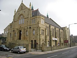
Tottington Hall
Tottington Hall, also known as Tottington Town Hall, is a municipal building in Market Street, Tottington, a town in Greater Manchester in England. The building, which served as the offices and meeting place of Tottington Urban District Council and now operates as a public library, is a grade II listed building.
2.0 km
Tottington, Greater Manchester
Tottington is a town in the Metropolitan Borough of Bury in Greater Manchester, England, on the edge of the West Pennine Moors. In 2011 it had a population of 9783.
Historically in Lancashire, it was a medieval fee, a type of royal manor, which encompassed several townships from Musbury and Cowpe with Lench in the north to Affetside in the west and Walshaw in the south west, while the township of Tottington itself was a small agricultural settlement surrounded by open farmland and hunting ground where deer and wild boar were found.