
 English
 Français

Goodmanham
Goodmanham est un village et une paroisse civile du Yorkshire de l'Est, en Angleterre. Il est situé à 3 km au nord-est de la ville de Market Weighton. Au moment du recensement de 2011, il comptait 244 habitants. Dans son Histoire ecclésiastique du peuple anglais, achevée en 731, l'historien Bède le Vénérable mentionne un lieu de culte païen situé à Godmunddingaham : lorsque le roi Edwin de Northumbrie se convertit au christianisme en 625, le grand prêtre Coifi se charge lui-même de détruire les anciennes idoles. Au XIe siècle, le village apparaît dans le Domesday Book sous le nom Gudmundham.
1. Références


1. Lien externe
(en) Goodmanham Parish Council Portail du Yorkshire
Nearby Places View Menu

0 m
Goodmanham
Goodmanham (historically Godmundingaham, the home of the people of Godmund) is a small village and civil parish in the East Riding of Yorkshire, England. It is situated approximately 2 miles (3 km) to the north-east of Market Weighton. The village is situated on the Yorkshire Wolds Way National Trail, a long-distance footpath.
According to the 2011 UK Census, Goodmanham parish had a population of 244, an increase on the 2001 UK Census figure of 218.
The village is built in a favourable position on a south-facing slope of the Yorkshire Wolds between two streams. It has a copious supply of water from numerous springs and naturally occurring limestone for building. The land is extraordinarily fertile in this region and people have lived here since prehistoric times.
1.0 km
Rifle Butts Quarry
Rifle Butts Quarry is a Site of Special Scientific Interest (SSSI) in the East Riding of Yorkshire, England. The particular interest of this reserve is the geological feature exposed on the quarry face. The site is owned by the Yorkshire Wildlife Trust. The exposure which is identified as being of national importance in the Geological Conservation Review shows a Cretaceous unconformity, where sediments from the Jurassic and Lower Cretaceous periods were eroded away. It shows a section of Red Chalk and White Chalk overlying Lias.
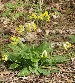
A shelter has been constructed to protect the quarry face from erosion. The reserve is situated on the western edge of the Yorkshire Wolds, one mile south-east of Goodmanham and two miles from Market Weighton. The site, which was designated a SSSI in 1952, has over 150 plants recorded. It still displays some characteristic chalk species, including cowslip, marjoram, field scabious and wild basil. Breeding birds include willow warbler and yellowhammer.

1.2 km
The Market Weighton School
The Market Weighton School is a coeducational secondary school located in Market Weighton in the East Riding of Yorkshire, England.
It is a community school administered by East Riding of Yorkshire Council. The school offers GCSEs and BTECs as programmes of study for pupils.

1.5 km
Market Weighton railway station
Market Weighton railway station was a railway station at the junction of the Selby to Driffield and York to Beverley lines in the East Riding of Yorkshire, England.

1.7 km
Market Weighton
Market Weighton ( WEE-tən) is a town and civil parish in the East Riding of Yorkshire, England. It is one of the main towns in the East Yorkshire Wolds and lies midway between Hull and York, about 20 miles (32 km) from either one. According to the 2021 UK Census Market Weighton parish had a population of 7,459, an increase on the 2011 UK census population of 6,429, which was an increase on the 2001 UK census figure of 5,212.