
 English
 Français

Brunswick (Tyne and Wear)
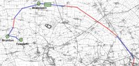
Brunswick est un village et une paroisse civile du Tyne and Wear, en Angleterre. Il est situé au nord du centre de Newcastle upon Tyne.
Nearby Places View Menu

388 m
Brunswick Village
Brunswick Village is a village split between North Tyneside and Newcastle upon Tyne, Tyne and Wear, England. It is situated approximately 6 miles north of Newcastle upon Tyne, and borders Hazlerigg, Dinnington and Wideopen. It was formerly known as Dinnington Colliery.

573 m
Wideopen
Wideopen, also occasionally misspelled as Wide Open, is a village in the North Tyneside metropolitan borough of Tyne and Wear, England, around 5 miles (8.0 km) north of Newcastle.
Wideopen adjoins the settlements of Seaton Burn, Brunswick Village and Hazlerigg. The village straddles the historic Great North Road, formerly the A1 trunk road, but is now bypassed by a new alignment of the A1 immediately to the west. The village lies in an area with a strong mining history and had its own colliery. Weetslade Country Park, to the east of the village, is reclaimed from an extensive area of coal mining activity.
In 2012 work commenced on the building of a new housing estate by Bellway homes, called Five Mile Park. It is located to the east of the Great North Road, between Lockey Park and Weetslade Country Park. The name refers to the distance from the centre of Newcastle; similarly, there is a Three Mile Inn to the south, and a Six Mile Bridge to the north.
800 m
Hazlerigg
Hazlerigg (often misspelled Hazelrigg) is a village and civil parish north of the City of Newcastle upon Tyne in Tyne and Wear, England. It is about 5 miles (8.0 km) north of the city centre, on the A1. It is split between Newcastle upon Tyne and North Tyneside, each side of the A1 being a different district. The parish council administer the Newcastle side, whereas the area located in North Tyneside is unparished. Much of the Newcastle Great Park development is within the area administered by the Hazlerigg Parish Council.
Located in the village is a post office, a fish & chip shop, a beauty salon, a hairdresser, a garage, a convenience store and a social club that is now open under new management. In spite of having a population of 1,053, and almost 800 homes, Hazlerigg has never had a pub. The population of the civil Parish taken at the 2021 Census was 1,114.
The village Community Centre is located at the west of the village next to the 'show field', formerly the site of the annual village Gala. A football field is located between Hazlerigg and the neighbouring Brunswick Village. Although Brunswick Village is only a 2-minute walk from Hazlerigg, the journey may take longer by car as there is no direct road linking the two villages, as they were once separated by a railway line for coal wagons. The path between the villages now follows the route of this wagonway. The shortest journey by road is two miles via Wideopen and the old Great North Road. The village is now being expanded by a large housing development called Havannah Park to the west, across the road from the Havannah Nature Reserve.

970 m
Big Waters
Big Waters is nature reserve in Tyne and Wear, England, a pond formed by former mine workings. It is the largest body of open water in the region, and is designated a Site of Special Scientific Interest. The eastern part of the pond is a public recreation area, Big Waters Country Park, managed by Newcastle City Council. The western part is managed by Northumberland Wildlife Trust.
1.2 km
Seaton Burn Wagonway
The Seaton Burn Wagonway (originally known as the Brunton and Shields Railway) was from 1826 to 1920 a partially horse-drawn and partially rope-operated industrial railway with a gauge of 4 ft 6 in (1,372 mm) near Newcastle upon Tyne.