
 English
 Français
The Reivers Way is a long-distance footpath in Northumberland, passing through the Northumberland National Park and the Cheviot Hills. Totalling 242 kilometres (150 mi) it starts in the Roman township of Corbridge and crosses the Hexhamshire Common before heading up along Hadrians Wall. Via Wark and Rothbury it heads into the Cheviot range via Clennell Street leading up to The Cheviot before dropping down to Wooler. From Wooler the path passes through Belford to the Northumbrian Saxon's capital of Bamburgh, and then follows the Northumberland Coast Path through Seahouses to Alnmouth.
Lieux à Proximité Voir Menu

1.4 km
Hepple
Hepple est une paroisse civile et un village du Northumberland, en Angleterre. La population de la paroisse civile au recensement de 2011 était de 144 habitants.

4.2 km
Thropton
Thropton est une paroisse civile et un hameau du Northumberland, en Angleterre. La population de la paroisse civile au recensement de 2011 était de 458 habitants.

5.0 km
Snitter
Snitter est une paroisse civile et un village du Northumberland, en Angleterre.

6.4 km
Cartington
Cartington est une ancienne paroisse civile et un village du Northumberland, en Angleterre.
6.6 km
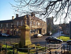
Rothbury
Rothbury est une ville de 2 107 habitants dans le Northumberland en Angleterre.
La ville est connue pour abriter le domaine de Cragside, demeure de William George Armstrong.