
 English
 Français
Porter Brook
The Porter Brook is a river which flows through the City of Sheffield, England, descending over 1,000 feet (300 m) from its source on Burbage Moor to the west of the city to its mouth where it joins the River Sheaf in a culvert beneath Sheffield railway station. Like the other rivers in Sheffield, its steep gradient made it ideal for powering water mills and works associated with the metalworking and cutlery industries, and around 20 dams were constructed over the centuries to facilitate this. At its lower end, it is extensively culverted, but parts of it are gradually being restored to open channels, as part of a daylighting scheme for the city. The brook derives its name from its brownish colour, similar to the colour of Porter beer.
Nearby Places View Menu

579 m
Limb Brook
The Limb Brook is a stream in Sheffield, South Yorkshire, England. It rises at the village of Ringinglow, flowing east through Whirlow and Ecclesall Woods into Abbeydale in the Beauchief area, where it merges with the River Sheaf. Near this point part of the stream has been diverted to provide the goit for the Abbeydale Industrial Hamlet millpond, and this channel flows through what is now Beauchief Gardens.

646 m
Ringinglow
Ringinglow is a village in the western section of Sheffield, England. It is on the western border of Ecclesall Ward, and although it is within the boundary of Sheffield, it is self-contained, being entirely surrounded by open countryside. The village now falls within the Fulwood ward of the City.
The village is focussed on the intersections of Fulwood Lane and Sheephill Road (historically this section was known as Houndkirk Road) with Ringinglow Road. The sources of the Porter Brook and Limb Brook, both tributaries of the River Sheaf, are near the village. The Norfolk Arms, a pub in the village, is often used as a staging-post by ramblers following one of these rivers out of Sheffield towards the Peak District National Park, the eastern boundary of which runs through the village. The Peak District Boundary Walk runs through the village.

1.0 km
Fulwood Hall
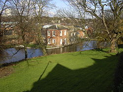
Fulwood Hall, (archaic: Fullwood Hall) is an English country house situated on Harrison Lane in the suburb of Fulwood in Sheffield, England. It is a Grade II listed building. The hall stands in a lofty position on the north side of the Mayfield Valley at a height of 270 metres (885 feet). The hall is referred to as Fullwood Hall on old maps and the gate to the hall uses this spelling with two Ls.

1.4 km
Porter Valley Parks
The Porter Valley Parks are a series of public parks and green spaces in Sheffield, England. Lying along the valley of Porter Brook, they run radially out from the city centre, providing a direct green-space connection to the Peak District national park. Created variously between 1855 and 1938, they comprise in order from the city centre; Endcliffe Park, Bingham Park, Whiteley Woods, Forge Dam Park and Porter Clough.
The parks are listed at Grade II on the Register of Historic Parks and Gardens. The Friends of the Porter Valley is a registered charity which supports their maintenance and improvement.
National Cycle Route 6 passes through parts of Bingham Park, Whiteley Woods and Porter Clough.