Location Image

Ardlamont House

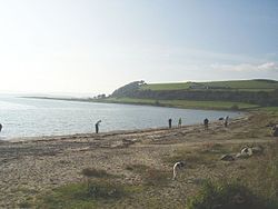
Ardlamont House is a Georgian estate house in Argyll, Scotland. It is surrounded by the Ardlamont Estate and adjacent to Ardlamont Point, the southern-most point point of the Cowal peninsula. It is some 5.5 kilometres (3.4 mi) south of Kames. The two-storey house is harled. The main block has a piended (hipped) slate roof, while the single-storey wings have skew (sloping) gables. A well-preserved obelisk sundial is located in the garden, whilst a range of estate buildings is nearby. All three are designated as Category B listed buildings by Historic Environment Scotland. The house was built c.1820 for Major General John Lamont, 19th chief of the Clan Lamont. The house and estate, by then rented out, were the location of the Ardlamont murder in 1893. The house and estate were sold in the same year by Major John Henry Lamont, the 21st chief of the clan.

Nearby Places View Menu
Location Image
5.2 km

Sgat Mòr and Sgat Beag

Sgat Mòr and Sgat Beag (Scottish Gaelic pronunciation: [s̪kat̪ moːrˠ ɪs̪ s̪kat̪ pɛk]; English: The Skate Islands or, less commonly, Skate Island and Wee Skate Island) are two small islands that lie at the mouth of Loch Fyne by the shore of the Cowal peninsula on the west coast of Scotland. Sgat Mòr lies at grid reference NR930666 directly south of Eilean Aoidhe and rises just 11 metres (36 ft) above sea level. Sgat Beag is a similar but slightly smaller island that lies approximately 1 kilometre to the east, across the mouth of Asgog Bay. The islands appear to have been named after the Skate fish however there is a Skate Point and Skate Bay on nearby Great Cumbrae so it is not impossible that skate is a local toponym with a different derivation. The channel between Sgat Mòr and the Cowal shoreline at Eilean Aoidhe is navigable and local sailing regattas, paddle steamer Waverley and MV Balmoral regularly pass inside this narrow channel. The waters to the south of the islands are the deepest in the Clyde area. A beacon resembling a small lighthouse is situated on the southwestern shore of Sgat Mòr.
Location Image
5.2 km

Ettrick Bay

Ettrick Bay is a wide, tidal, sandy coastal embayment with a chord of 1 mile (2 km), on a 218° bearing, located on the west coast of the Isle of Bute in the Firth of Clyde, within council area of Argyll and Bute in Scotland. The bay was used for practice training for the D-Day landings.
Location Image
5.3 km

Millhouse, Argyll

Millhouse is a village in the parish of Kilfinan. Located on the B8000 inland from Kames in the east and Portavadie in the west, on the Cowal Peninsula, in Argyll and Bute, west of Scotland.
Location Image
5.5 km

Kames, Argyll

Kames (Scottish Gaelic: Camas nam Muclach) is a small village on the Cowal Peninsula, in Argyll and Bute, west of Scotland, on the shore of the west arm of the Kyles of Bute. Kames is now part of a continuous coastal strip of housing that joins onto Tighnabruaich. Kames has a grocery shop (containing a post office, and relaunched under new management as the "Kames Village Store" in late 2016), a church and a hotel. The Kames Hotel has views over the west arm of the Kyles of Bute.