


Wallis Sands State Beach is a public recreation area located on the Atlantic Ocean in the town of Rye, New Hampshire. The state park offers a sandy beach with bathhouse, picnicking, and 500-car pay-parking lot.
Location
1 explorer visited this place
940 m
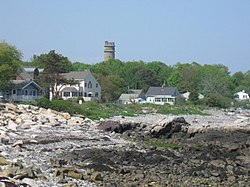
Pulpit Rock Tower, also known as Pulpit Rock Base-End Station, is a historic military observation tower at 9 Davis Road in Rye, New Hampshire. Built in 1943 as part of the Harbor Defenses of Portsmouth, a series of military defenses around Portsmouth, it is the only one of fourteen World War II-era observation posts to survive. Now owned by the state, it is periodically open to the public, and maintained by a local non-profit organization. It was listed on the National Register of Historic Places in 2010.

2.1 km
Odiorne Point State Park is a public recreation area located on the Atlantic seacoast in the town of Rye near Portsmouth, New Hampshire, in the United States. Among the park's features are the Seacoast Science Center and the remains of the World War II Fort Dearborn. The park offers opportunities for hiking, cycling, picnicking, fishing, and boating.
2.2 km
Rye Air Force Station is a closed United States Air Force General Surveillance Radar station. It is located 3.1 miles southeast of Portsmouth, New Hampshire in what is now Odiorne Point State Park. It was closed in 1957.

3.2 km
Rye Harbor State Park is a public recreation area located on the Atlantic Ocean in the town of Rye, New Hampshire. The portion of the state park located on the peninsula known as Ragged Neck offers scenic views of the ocean, the Isles of Shoals, and the town harbor. Activities include saltwater fishing and picnicking. Amenities include benches, picnic tables, pavilion, and restrooms.
The park includes the 1614 Monument, an obelisk dedicated in 2014 to Captain John Smith, who explored the coast of New England in 1614. Also in the park is New Hampshire Historical Marker No. 18, which provides information about the Isles of Shoals.

3.6 km
Fort Stark is a former military fortification in New Castle, New Hampshire, United States. Located at Jerry's Point on the southeastern tip of New Castle Island, most of the surviving fort was developed in the early 20th century, following the Spanish–American War, although there were several earlier fortifications on the site, portions of which survive. The fort was named for John Stark, a New Hampshire officer who distinguished himself at the Battle of Bennington in the American Revolution. The purpose of Fort Stark was to defend the harbor of nearby Portsmouth and the Portsmouth Naval Shipyard. The fort remained in active use through the Second World War, after which it was used for reserve training by the US Navy. The property was partially turned over to the state of New Hampshire in 1979, which established Fort Stark Historic Site, and the remainder of the property was turned over in 1983. The grounds are open to the public during daylight hours.