


Pulpit Rock Tower, also known as Pulpit Rock Base-End Station (N. 142), is a historic military observation tower at 9 Davis Road in Rye, New Hampshire. Built in 1943 as part of the Harbor Defenses of Portsmouth, a series of military defenses around Portsmouth, it is the only one of fourteen World War II-era observation posts to survive.
Book your tour near
Pulpit Rock Tower
Book Now
4.2
in partnership with
GetYourGuide.com
Location
1 explorer visited this place

940 m
Wallis Sands State Beach is a public recreation area located on the Atlantic Ocean in the town of Rye, New Hampshire. The state park offers a sandy beach with bathhouse, picnicking, and 500-car pay-parking lot.

1.2 km
Odiorne Point State Park is a public recreation area located on the Atlantic seacoast in the town of Rye near Portsmouth, New Hampshire, in the United States. Among the park's features are the Seacoast Science Center and the remains of the World War II Fort Dearborn. The park offers opportunities for hiking, cycling, picnicking, fishing, and boating.
1.3 km
Rye Air Force Station is a closed United States Air Force General Surveillance Radar station. It is located 3.1 miles southeast of Portsmouth, New Hampshire in what is now Odiorne Point State Park. It was closed in 1957.

2.7 km
Fort Stark is a former military fortification in New Castle, New Hampshire, United States. Located at Jerry's Point on the southeastern tip of New Castle Island, most of the surviving fort was developed in the early 20th century, following the Spanish–American War, although there were several earlier fortifications on the site, portions of which survive. The fort was named for John Stark, a New Hampshire officer who distinguished himself at the Battle of Bennington in the American Revolution. The purpose of Fort Stark was to defend the harbor of nearby Portsmouth and the Portsmouth Naval Shipyard. The fort remained in active use through the Second World War, after which it was used for reserve training by the US Navy. The property was partially turned over to the state of New Hampshire in 1979, which established Fort Stark Historic Site, and the remainder of the property was turned over in 1983. The grounds are open to the public during daylight hours.
2.9 km
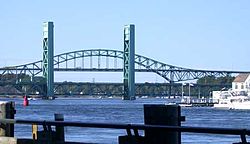
The Piscataqua River) is a 12-mile-long tidal river forming the boundary of the U.S. states of New Hampshire and Maine from its origin at the confluence of the Salmon Falls River and Cochecho River to the Atlantic Ocean. The drainage basin of the river is approximately 1,495 square miles, including the subwatersheds of the Great Works River and the five rivers flowing into Great Bay: the Bellamy, Oyster, Lamprey, Squamscott, and Winnicut.
The river runs southeastward, with New Hampshire to the south and west and Maine to the north and east, and empties into the Gulf of Maine east of Portsmouth, New Hampshire. The last 6 miles before the sea are known as Portsmouth Harbor and have a tidal current of around 4 knots. The river has very strong currents and is considered one of the swiftest in the United States. The cities/towns of Portsmouth, New Castle, Newington, Kittery and Eliot have developed around the harbor.
Now owned by the state, it is periodically open to the public, and maintained by a local non-profit organization. It was listed on the National Register of Historic Places in 2010.
Book your tour near
Pulpit Rock Tower
Book Now
4.2
in partnership with
GetYourGuide.com