Muckle Moss is a Site of Special Scientific Interest (SSSI) and a National Nature Reserve located near Bardon Mill in Northumberland, England. Muckle Moss is a mire over deep peat, and its boundaries include Blackdyke Plantation. Muckle Moss SSSI was previously notified as part of Roman Wall SSSI.

1. Details

The central area of the protected area is dominated by the mosses Sphagnum magellanicum, Sphagnum papillosum, Sphagnum recurvum and Sphagnum cuspidatum. Rare moss species recorded here include Sphagum riparium, Sphagnum balticum and Sphagnum dusenii. Heather and cross-leaved heath are present on ridges. Insect species recorded at this protected area include large heath butterfly and green hairstreek butterfly. This peatland previously supported a plantation and the peatland was historically modified by draining.

1. Land ownership

Muckle Moss SSSI is situated within the Crow Hall Farm estate.

1. References
Nearby Places View Menu
Location Image
2.0 km

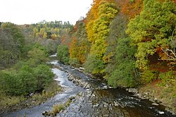
River Allen, Northumberland

The River Allen is a river in the English county of Northumberland. The river has its sources in the hills of the Northern Pennines, and is formed by the confluence of the East and West Allen rivers. The Allen is a tributary of the River South Tyne, which itself, a tributary of the River Tyne. The Allen was formerly very polluted from mining activity upstream, but remediation schemes have been implemented to allow the water quality to improve. The river is home to a variety of wildlife including voles and otters.
Location Image
2.1 km

A69 road

The A69 is a major northern trunk road in England, running east–west across the Pennines, through the counties of Tyne and Wear, Northumberland and Cumbria. Originally, the road started in the centre of Newcastle upon Tyne then later near Birtley, but since the creation of the A1 Western Bypass around Newcastle upon Tyne, it now starts at Denton Burn, a suburb of Newcastle upon Tyne. The route from the A1 junction to Carlisle city centre is 54 miles (87 km).
Location Image
2.4 km

Stanegate

The Stanegate (meaning "stone road" in Northumbrian dialect) was an important Roman road and early frontier built in what is now northern England. It linked many forts including two that guarded important river crossings: Corstopitum (Corbridge) on the River Tyne in the east (situated on Dere Street) and Luguvalium (Carlisle) on the River Eden in the west. The Stanegate ran through the natural gap formed by the valleys of the River Tyne in Northumberland and the River Irthing in Cumbria. It predated the Hadrian's Wall frontier by several decades; the Wall would later follow a similar route, albeit slightly to the north. The Stanegate should not be confused with the two Roman roads called Stane Street in the south of England, namely Stane Street (Chichester) and Stane Street (Colchester). In both these cases the meaning is the same as for the northern version, indicating a stone or paved road. The Stanegate differed from most other Roman roads in that it often followed the easiest gradients, and so tended to weave around, whereas typical Roman roads follow a straight path, even if this sometimes involves having punishing gradients to climb. A large section of the Stanegate is still in use today as a modern minor road between Fourstones and Vindolanda in Northumberland.
Location Image
2.5 km

Milecastle 36

Milecastle 36 (King's Hill) was one of the milecastles on Hadrian's Wall (grid reference NY79726931). There is little to see on the ground as most of the walls have been robbed and quarried away.