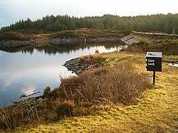
Knapdale (gaélique écossais : Cnapadal) est un district rural d'Argyll and Bute dans les Highlands, qui touche Kintyre au sud, et est séparé du reste d'Argyll au nord par le Crinan Canal. Il comprend deux paroisses, North Knapdale et South Knapdale. La forêt de Knapdale, plantée dans les années 1930, couvre une vaste partie de la région. Durant les années 1930, le Ministre du travail charge des hommes auparavant sans emploi, venant souvent des mines et de l'industrie lourde, deux secteurs en crise, de planter cette forêt. Ces hommes sont logés dans un des nombreux centre d'instruction créé par le ministre, la plupart appartenant à la Forestry Commission. En 1938, le ministère dispose de 38 centres d'instruction à travers la Grande-Bretagne. Le camp avait été utilisé par la passé pour garder les prisonniers ennemis durant la Seconde Guerre mondiale. Il est situé à Cairnbaan, juste au sud du Crinan Canal, et un des bâtiments encore existant est utilisé comme atelier par la Forestry Commission. Les attractions locales comprennent la chapelle de Keills. Une pierre gravée dans la chapelle est gravé d'une clarsach similaire à la harpe de la reine Marie actuellement au musée d'Écosse à Édimbourg, une des seulement trois harpes gaéliques encore existantes. Cela pourrait signifier que la harpe vient de Knapdale. On peut également trouver dans la région la chapelle de Kilmory et le château de Sween du XIe siècle. En 2005, le gouvernement écossais abandonne son programme de réintroduction du Castor européen à Knapdale. Toutefois, à la fin de l'année 2007, on met en place une application fructueuse du projet, et les premiers castors sont relâchés le 29 mai 2009. La remise en liberté de 11 animaux prend un coup d'arrêt avec la disparition de deux animaux, tandis qu'un troisième pourrait avoir été victime de braconniers, mais de nouveaux lâchers ont lieu en 2010. Knapdale est une National Scenic Area. Le district inclut les villages suivants :

Achnamara, Ardrishaig Crinan Kilberry, Kilmory Tayvallich Le recensement de 2001 reporte une population de 2325 habitants, ne baisse comparé aux 2641 de 1991. On observe une augmentation dans le North Knapdale où l'on passe de 312 à 527, tandis que dans le South Knapdale on passe de 2641 à 2325 habitants. Les recensements montrent un déclin continue de la population en North Knapdale, qui a connu un pic à 2700 habitants en 1825 pour passer sous les 500 en 1950. Une possible modification des frontières rend l'analyse plus difficile pour South Knapdale, mais cette région semble connaître un déclin moins important, et a connu une augmentation d'habitants dont le nombre est passé de 1750 en 1801 à environ 2700 en 1901.

Nearby Places View Menu
Location Image
0 m

Knapdale

Knapdale (Scottish Gaelic: Cnapadal, IPA: [ˈkɾaʰpət̪əl̪ˠ]) forms a rural district of Argyll and Bute in the Scottish Highlands, adjoining Kintyre to the south, and divided from the rest of Argyll to the north by the Crinan Canal. It includes two parishes, North Knapdale and South Knapdale. The area is bounded by sea to the east and west (Loch Fyne and the Sound of Jura respectively), whilst the sea loch of West Loch Tarbert almost completely cuts off the area from Kintyre to the south. The name is derived from two Gaelic elements: Cnap meaning hill and Dall meaning field. Knapdale gives its name to the Knapdale National Scenic Area, one of the forty national scenic areas in Scotland, which are defined so as to identify areas of exceptional scenery and to ensure their protection from inappropriate development. The designated area covers 32,832 hectares (81,130 acres) in total, of which 20,821 hectares (51,450 acres) is on land and 12,011 hectares (29,680 acres) is marine (i.e. below low tide level).
Location Image
2.1 km

Cam Loch

Cam Loch (the Crooked Loch) is one of a number of water supply sources for the Crinan Canal. The impounding reservoir lies to the south of the canal and about 3 kilometres west of Lochgilphead. It has an earthwork dam 8.5 metres high, with records showing that construction was before 1860.
Location Image
2.2 km

Gleann Loch

The loch runs south west to north east and is an impounding reservoir located to the west of Lochgilphead, Scotland. It is one of a number of lochs supplying water to the Crinan Canal. The earthen dam is 15 metres high. Records show the dam was constructed before 1860.
Location Image
2.4 km

Kilduskland Reservoir

Kilduskland Reservoir is of the impounding variety and is located 2 kilometres west of Ardrishaig, supplying the village with its water supply. The concrete dam is 9 metres high and it was completed in 1906.
Location Image
2.5 km

Loch an Add

Loch an Add is a reservoir in Argyll, Scotland, roughly 3 km southwest of the village of Cairnbaan and 6 km west of the larger settlement of Lochgilphead. It is roughly 1 mile (1.6 km) long and up to 280 metres wide, and is longitudinal in a SW/NE orientation, occupying one several small parallel valleys between successive ridges (a geological formation closely resembling that of Anglesey) in an area of coniferous forest. It is not to be confused with Lochan Add, a smaller body of water with roughly the same shape and orientation, but situated about 20 km to the north-east. Furthermore, neither of these two lochs is connected to the River Add, mentioned below. The loch is one of several reservoirs within the Glen Clachaig Feeder System that supplies water to the Crinan Canal. It is maintained by an earthen dam at its north end, and is currently managed by Scottish Canals. Immediately downstream of this dam is another reservoir, Daill Loch, which is drained by the Dunardy Burn into the Crinan Canal. Loch an Add was first named in 1814 by Scottish engineer Hugh Baird, designer of the Crinan and Union Canals. Baird's toponymy is unclear. One explanation is that it derives from the same Scottish Gaelic root as the River Add, àd or fhàd, which is a lenited form of fada meaning "long" i.e. "Long Loch". Another explanation is that Add is an Anglicisation of àth, meaning "ford" i.e. "Loch of the Ford". The loch has a large stock of brown trout.