


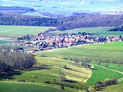
The Dün (German pronunciation: [dyːn]) is a hill chain in northwestern Thuringia, Germany. It runs west to east, and forms the northwestern edge of the Thuringian Basin. It separates the Thuringian Basin from the upper valley of the river Leine. Towards the east it continues in the Hainleite ridge. The highest point, 522 m above sea level, is near the village Vollenborn.
Location
1 explorer visited this place
736 m
Vollenborn is a village and a former municipality in the district of Eichsfeld in Thuringia, Germany. Since 31 December 2013, it is part of the municipality Deuna.
3.1 km
Gerterode is a village and a former municipality in the district of Eichsfeld in Thuringia, Germany. Since 1 January 2019, it is part of the municipality Niederorschel.
3.1 km
Deuna is a village and a former municipality in the district of Eichsfeld in Thuringia, Germany. Since 1 January 2019, it is part of the municipality Niederorschel.
4.8 km
Rüdigershagen is a village in the municipality of Niederorschel in Eichsfeld, Thuringia, Germany. Rüdigershagen is located one the north slope of the Dün hills, and has approximately 600 inhabitants.
Book your tour near
Dün
→