
 English
 Français

Notton
Notton est un village et une paroisse civile du Yorkshire de l'Ouest, en Angleterre.
Nearby Places View Menu
3 m
Notton
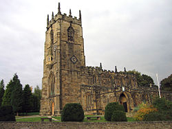
Notton is a village and civil parish in the City of Wakefield district of West Yorkshire, England. The village is approximately 1 mile (1.6 km) north-west of Royston, 5.5 miles (9 km) from Barnsley town centre and 6.5 miles (10 km) south of Wakefield. The parish had a population of 982 at the 2011 Census.
The name Notton derives from the Old English hnoctūn meaning 'wether (castrated male sheep) settlement'.
In the Middle Ages the manor was held by the de Notton family, whose most notable member was William de Notton (died about 1365), who was Lord Chief Justice of Ireland. It later passed to the Darcy family.
Notton was in the West Riding of Yorkshire in the Staincross Wapentake and part of the ancient parish of Royston. Until 1974, the parish was part of Wakefield Rural District, before then Notton was part of the Barnsley Rural District before its abolition in 1938.
Notton has a village hall on George Lane, and a post office on Applehaigh Lane.

1.3 km
Notton and Royston railway station
Notton and Royston railway station was a railway station that served the village of Royston, South Yorkshire, England. It was situated on the Barnsley Coal Railway between Staincross and Mapplewell and Ryhill.
The first section of the line to open was that from Stairfoot to Applehaigh (just north of Notton and Royston station) in 1870 so that Rosa Colliery could be served. The station opened, along with two others on the line, on 1 September 1882, and was closed to passengers by the LNER on 22 September 1930.
It had flanking platforms and simple buildings to house all the facilities constructed in wood.
1.6 km
Royston, South Yorkshire
Royston is a suburban village within the Metropolitan borough of Barnsley, in South Yorkshire, England. Historically, the village formed part of the West Riding of Yorkshire, but was incorporated into the Metropolitan borough of Barnsley in 1974 and is now on the border with West Yorkshire.
It is part of the Barnsley Central borough constituency, and has a population of 10,728. It is situated 4 miles (6.4 km) north-east of Barnsley, and 6 miles (9.7 km) south-east of Wakefield.
1.9 km
Royston High School
Royston High School was a state school in Barnsley, South Yorkshire, England.
Along with City School, Sheffield, Royston High School had links with Malealea in Lesotho, small groups of pupils visited biannually. Pupils and parents organised fund raising activities throughout the year to help the villagers in Malealea.
In 2009, Royston High School was merged with nearby school, Edward Sheerien and was renamed Carlton Community College. Primarily, the school was situated on two different sites which were the old Royston and Athersly campuses. In December 2010, the school moved to a new building in Carlton. The school was renamed Outwood Academy Carlton in 2016.

2.2 km
Woolley Hall
Woolley Hall is a country house in Woolley, West Yorkshire, England. It is a Grade II* listed building.