


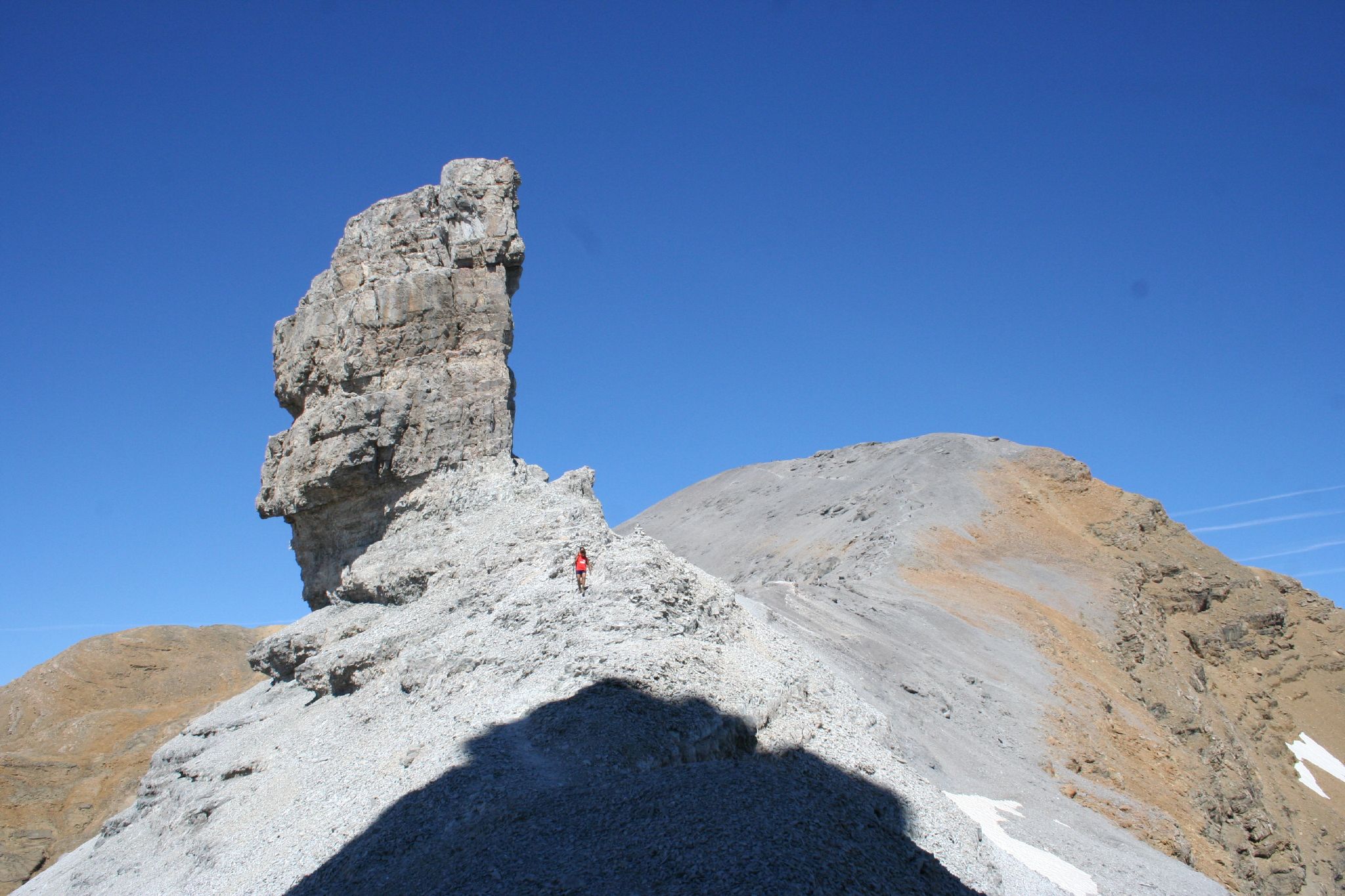
Pic du Taillon (in French) or Pico Taillón (in Spanish) is a summit in the Pyrenees, culminating at 3,144 m (10,315 ft) on the Franco-Spanish border in the Monte Perdido Range. Pic du Taillon is considered one of the easiest 3,000ers above the Cirque de Gavarnie. Only the last part from the "finger" of the False Defile (le Doigt de la Fausse Brèche) is a little steep, but the climb never technically difficult in the absence of snow.
Gallery


Sponsored
Location

1.8 km
The Cirque d'Estaubé is a cirque in the central Pyrenees in the Pyrenees National Park, forming the frontier between France and Spain. The cirque lies 4 km to the east of its better known neighbour, the Cirque de Gavarnie, which is accessible via the Hourquette d'Alans; the Marboré valley is reached via the Brèche de Tuquerouye, where there is a small CAF hut.
The Gave d'Estaubé descends north from the cirque, first flowing into a small reservoir, the Barrage des Gloriettes, then into the main Héas valley.

2.1 km
The Casque du Marboré, or Casque de Gavarnie or simply le Casque, is a Pyrenean summit, culminating at 3,006 m, located on the crest of three-thousanders in the Monte Perdido Range above Cirque de Gavarnie on the Franco-Spanish border.

2.5 km
Cilindro de Marboré is a mountain in the Monte Perdido massif in the Pyrenees.
It is one of the three mountains comprising Las Tres Sorores, the others being Monte Perdido and Soum de Ramond.
It is the northernmost point of Spain crossed by the IERS Reference Meridian.

2.5 km
Ordesa y Monte Perdido National Park is an IUCN Category II National Park situated in the Pyrenees. There has been a National Park in the Ordesa Valley since 1918. Its protected area was enlarged in 1982 to cover the whole region, amounting to 156.08 square kilometres.
It has been included since 1997 by UNESCO in the Biosphere Reserve of Ordesa-Viñamala. In the same year it was included in the cross-border Pyrénées - Mont Perdu World Heritage Site because of its spectacular geologic landforms.

2.7 km
Soum de Ramond, also known as Pico de Añisclo in Spanish and Aragonese, is a mountain of 3,263 metres in the Monte Perdido massif in the Aragonese Pyrenees in northern Spain. It is one of the three mountains comprising Las Tres Sorores, the others being Monte Perdido and Cilindro de Marboré.
The mountain lies between the Ordesa Valley, the Añisclo Canyon and the Pineta Valley, inside the Ordesa y Monte Perdido National Park. The Aragonese name "Pico Anyisclo" originates from the eponymous valley in the Aragonese Pyrenees. Later on, the mountain was named "Soum de Ramond" after Louis Ramond de Carbonnières, the French politician, geologist and botanist.
The panorama from the summit is grandiose, offering a view of the Monte Perdido Range, the Vignemale Range, the Néouvielle Range, Balaïtous and Pic du Midi de Bigorre on a clear day.
