Knock is a small village in the Westmorland and Furness district of Cumbria, England, and 1.9 km northwest of the larger village of Dufton and 3.1 km south of the village of Milburn. It lies midway between Cross Fell to the north and the town of Appleby-in-Westmorland to the south. Knock is situated 1 km east of the small hamlet and farm, Knock Cross.

1. History, geography and toponymy

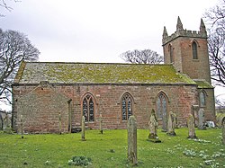
The place-name 'Knock' is first attested in a Yorkshire charter from between 1150 and 1162, where it appears as Chonoc-salchild. It appears as Knok in an Inquisition post mortem of 1323. The name means 'hillock', from the Brittonic *cnuc, Old Irish cnocc or Irish cnoc; an apparent reference to the nearby Knock Pike, which is 1,306 feet high, and can be seen in the photo to the right. Circa 1870, it had a population of 197 as recorded in the Imperial Gazetteer of England and Wales. Knock is also shown on Thomas Jefferys's 1770 map of Westmorland. Knock once had a Methodist chapel, but that was closed and the chapel at Dufton was renamed "Dufton with Knock Methodist Church". The former chapel in Knock was gutted in a fatal fire in April 2018 that killed two people.

1. See also

Listed buildings in Long Marton

1. References


1. External links

Cumbria County History Trust: Long Marton (nb: provisional research only – see Talk page)

Nearby Places View Menu
Location Image
887 m

St Cuthbert's Church, Dufton

St Cuthbert's Church is situated 3⁄4 mile (1.2 km) north of the village of Dufton, Cumbria, England. It should not be confused with the nearby St Cuthbert's church, Milburn. It is an active Anglican parish church in the deanery of Appleby, the archdeaconry of Carlisle, and the diocese of Carlisle. The parish is one of ten parishes which form the benefice of the Heart of Eden. The Parish Church of St Cuthbert, Dufton, is situated north-west of the village of Dufton – the name of which means 'dove farm' – and nestles beneath the eastern fells above the Eden Valley, about 3 miles (4.8 km) north of Appleby and 12 miles (19 km) south-east of Penrith. From the new churchyard, fine views are to be had of Dufton Pike and the Pennines.
Location Image
1.9 km

Dufton Pike

Dufton Pike is a hill in the northern Pennines, in Cumbria, England. It is 481 metres (1,578 ft) above sea level and is classed as a Marilyn (a hill with topographic prominence of at least 150m). It rises above the village of Dufton. Dufton Fell lies between the pike and Cow Green Reservoir.
Location Image
2.1 km

Dufton

Dufton is a village and civil parish in Cumbria, England. Historically part of Westmorland, it lies in the Eden Valley and below Great Dun Fell. It is mostly around 180m above sea level. At the 2011 census the parish had a population of 201 , increasing to 204 at the 2011 Census The centre of the village is built around a green, on the north side of which is the Stag Inn. The village green is oblong in shape and is bisected by an avenue of lime trees that crosses it diagonally. Houses in the village were built from the 17th century onwards and the village has changed little over the last 100 years.
Location Image
2.4 km

Swindale Beck (Dufton)

Swindale Beck is an upland stream in Cumbria, England, which for much of its length forms the boundary between the civil parishes of Long Marton and Dufton in the Westmorland and Furness unitary authority area. It rises south of Knock Fell and flows into the Trout Beck at Long Marton to feed the River Eden. The eastern area of its catchment falls within the Appleby Fells which is a Site of Special Scientific Interest. It is crossed by a grade II listed packhorse bridge north east of Knock Pike. The Pennine Way crosses Swindale Beck on a footbridge, between Dufton and Knock Fell.