
 English
 Français

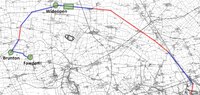
Brenkley
Brenkley is a hamlet and former civil parish about 6 miles from Newcastle upon Tyne, now in the parish of Dinnington, in the Newcastle upon Tyne district, in the county of Tyne and Wear, England. In 1951, the parish had a population of 28.
Nearby Places View Menu

1.9 km
Big Waters
Big Waters is nature reserve in Tyne and Wear, England, a pond formed by former mine workings. It is the largest body of open water in the region, and is designated a Site of Special Scientific Interest. The eastern part of the pond is a public recreation area, Big Waters Country Park, managed by Newcastle City Council. The western part is managed by Northumberland Wildlife Trust.
2.0 km
Seaton Burn Wagonway
The Seaton Burn Wagonway (originally known as the Brunton and Shields Railway) was from 1826 to 1920 a partially horse-drawn and partially rope-operated industrial railway with a gauge of 4 ft 6 in (1,372 mm) near Newcastle upon Tyne.
2.1 km
Dinnington, Tyne and Wear
Dinnington is a village and civil parish in the city of Newcastle upon Tyne in Tyne and Wear, England. It is about 9 miles (14 km) north of the city centre, and about 5 miles (8.0 km) north-east of Newcastle International Airport. According to the 2011 Census, Dinnington Parish has 737 households and a population of 1,636; of whom 358 are 65 or over (almost 22%).

2.1 km
Castle, Newcastle upon Tyne
Castle is a ward of the city of Newcastle upon Tyne in North East England. The ward encompasses the villages of Brunswick, Dinnington and Hazlerigg. Castle ward borders the neighbouring authorities of North Tyneside and Northumberland. The population of the ward is 9,912 making up 3.8% of the total population of the city. The population of the ward had increased to 10,069 at the 2011 Census. Car ownership stands at 76.2% much higher than Newcastle's average of 54.7%. House prices in the area average at £189,400.