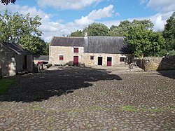
Mickley is a cluster of villages in the civil parish of Prudhoe, in Northumberland, England. It lies south of the River Tyne and is accessible via the A695. The electoral ward of Mickley comprises the hamlets of Mickley Square, West Mickley (including Mount Pleasant), High Mickley, plus Cherryburn and Eltringham Farm. The population is a little under one thousand. The Mickley settlements are served by St George's Church, which was built in 1830. Other facilities in Mickley include a First School, garden centre, two social clubs and a cafe on the A695. There is a public house (The Blue Bell Inn), dating from the 1820s, at Mount Pleasant. The Mickley area is physically situated on a steep, north-facing hill that reaches 203 metres above sea level on Mickley Moor, where views over to both the Simonside Hills and even the Cheviot Hills are often visible on a clear day.

Nearby Places View Menu
Location Image
1.0 km

West Mickley

West Mickley is a hamlet east of Stocksfield, in the southern part of Northumberland, England. Along with the neighbouring settlements of High Mickley and Mickley Square, it forms part of the electoral ward of Mickley, Northumberland. It is just over half a mile from the town of Prudhoe and is south of the River Tyne. It is not a big village, being nearly half a mile in length with a main road stretching the full length of it (A695). The small settlement of Mount Pleasant forms part of West Mickley. It has one of the few pubs in the area, the two-centuries-old Blue Bell Inn, though this is closed at the time of writing (2025). On foot, Mount Pleasant is directly accessible from the main part of West Mickley via a steep but paved uphill path alongside High Close Woods and the Belasis Burn. When driving or cycling, however, one needs to take Stonybank Way, which goes uphill just east of the petrol station at Branch End in the neighbouring village of Stocksfield.
Location Image
1.5 km

Cherryburn

Cherryburn is a cottage in Mickley, Northumberland, England. It was the birthplace of Thomas Bewick, an English wood engraver and ornithologist. The cottage, its adjacent farmhouse and large grounds, have been managed by the National Trust since 1991 when they took over responsibility for the site from the Bewick Birthplace Trust. Cherryburn is open to the public.
Location Image
1.6 km

A695 road

A695 road is a road in Northern England linking Newcastle upon Tyne, Tyne and Wear, with Hexham, Northumberland.
Location Image
1.6 km

Branch End

Branch End is part of the village of Stocksfield in Northumberland, England. It is situated at the junction of the A695 Main Road with New Ridley Road. It lies 1 mile (1.6 km) east of Stocksfield Station, between Hexham and Newcastle upon Tyne. Local services include a doctors' surgery, pharmacy, petrol station with associated shop and post office, two garages, a hairdresser, newsagent, children's play area and Quaker meeting house. There is a half hourly bus service to Hexham and Newcastle with Go North East "Tyne Valley 10".