
 English
 Français

Windy Nook
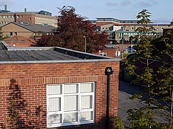
Windy Nook is an area in Tyne and Wear, England, bordered by Carr Hill to the west, Whitehills Estate and Leam Lane Estate to the east, Felling to the north and Sheriff Hill to the south. It lies on steep, sloping land 2.25 miles (3.62 km) south of Gateshead, 2.75 miles (4.43 km) south of Newcastle upon Tyne and 12 miles (19 km) north of Durham. In 2011, the Windy Nook and Whitehills ward had a population of 9,781. Formerly part of Heworth, it was incorporated into the newly formed Metropolitan Borough of Gateshead on 1 April 1974. Windy Nook has a long industrial history, with evidence of milling and pottery in the area. The principal industry, however, was stone quarrying, and the initial settlement grew as this industry flourished. By the turn of the 19th century, several quarries operated in Windy Nook and the largest, Kell's Quarry, provided the sandstone and grindstone used to build St Alban's Church, a Grade II listed building and principal landmark in the village, which was consecrated on 25 August 1842. The decline in industry in the 20th century saw the population fall to pre-industrial levels. Though today an urban suburb, there are no large commercial areas and the new Tesco store is the largest employer. There remains large areas of green space, however, and it is a popular and high-demand place to live. Residents compare favourably with others in the borough in terms of income, employment levels and educational qualifications. Windy Nook Nature Reserve is a protected wildlife area, as well as one of the largest environmental sculptures in Europe. Mary Elizabeth Wilson, a serial killer, was known as The Merry Widow of Windy Nook. Joseph Hopper, founder of the aged mineworkers scheme, and John Oxberry, a prominent historian, also hailed from the village.
Nearby Places View Menu
Queen Elizabeth Hospital, Gateshead
Gateshead Fell
Thomas Hepburn Community Academy
