
 English
 Français

Wythburn Church
Wythburn Church is situated in an isolated location beside the A591 road, on the eastern bank of Thirlmere in Cumbria, England. It is an active Anglican church in the deanery of Derwent, the archdeaconry of West Cumberland, and the diocese of Carlisle. Its benefice is united with those of St Mary, Threlkeld, and St John, St John's in the Vale. The church is recorded in the National Heritage List for England as a designated Grade II listed building. The poet William Wordsworth described it as a "modest house of prayer".
Nearby Places View Menu

0 m
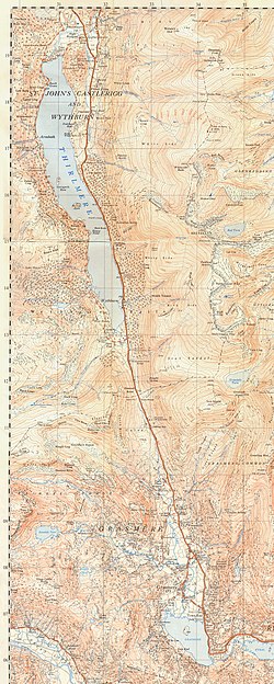
St John's, Castlerigg and Wythburn
St John's, Castlerigg and Wythburn is a civil parish in Cumberland district, Cumbria, England. In the 2011 census it was recorded as having a population of 422. There is a parish council; its archives 1894–1995 are held at the Cumbria Archive Service in Carlisle. in 2004 a parish plan was drawn up and approved by the parish council.
The parish covers an area on either side of the A591 road from Dunmail Raise in the south to the outskirts of Keswick in the north, and extends to include the valley of St John's in the Vale in the north east. The neighbouring parishes, listed anti-clockwise, are Lakes in Westmorland and Furness district to the south; Patterdale, Matterdale and Threlkeld also in Westmorland and Furness to the east, the border following the mountain ridge and crossing the summit of Helvellyn; Underskiddaw and Keswick to the north; and Borrowdale to the west.
There are 23 grade II listed buildings or structures in the parish including Wythburn Church and St John's Church, St John's in the Vale, and 10 scheduled monuments including Castlerigg stone circle.
The village of Wythburn was drowned in the construction of Thirlmere reservoir, completed in 1894, although its church survives.
The parish has also been known as Castlerigg St John's and Wythburn, and with various variations of the presence or absence of comma, full stop after "St", and apostrophe.

1.9 km
High Crag (Helvellyn)
High Crag is a minor fell on the Helvellyn Range in the eastern region of the English Lake District. It sits on the ridge to the south of Helvellyn and Nethermost Pike. It rises sharply above the head of Ruthwaite Cove, and has attracted the attention of rock climbers. Its rock type is a lapilli tuff of the Helvellyn Tuff Formation.
1.9 km
Dunmail Raise
Dunmail Raise is the name of a large cairn in the English Lake District, which may have been an old boundary marker. It has given its name to the mountain pass of Dunmail Raise, on which it stands. This mountain pass forms part of the only low-level route through the mountains between the northern and southern sides of the Lake District. According to local tradition, the cairn marked the burial of a king named Dunmail who was slain by Saxons. The place name itself may well be derived from the name of the historical Dyfnwal ab Owain, King of Strathclyde.

2.0 km
Nethermost Pike
Nethermost Pike is a fell in Cumbria, England, and a part of the Lake District. At 891 metres (2,923 ft) it is the second highest Wainwright in the Helvellyn range, the highest of which is Helvellyn itself. It is located close to the southern end of the ridge, with Helvellyn to the north, and High Crag and Dollywaggon Pike to the south. Nethermost Pike, along with many of the Eastern Fells, lies between Thirlmere in the west and the Ullswater catchment in the east. The closest villages are Glenridding and Patterdale on the shores of Ullswater, over 8 kilometres (5 mi) away.
Like most fells in the Helvellyn range, Nethermost Pike has grassy western slopes and rocky outcrops on the eastern side. Geologically, Nethermost Pike belongs to the Borrowdale Volcanic Group. Lead was once mined on its eastern slopes, resulting in open workings and underground mines. The eastern slopes are protected as part of a Site of Special Scientific Interest because of the Pike's geological and biological features, which include some of England's best arctic-alpine and tall-herb vegetation.