
 English
 Français
North Gosforth Academy
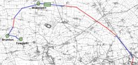
North Gosforth Academy is a co-educational secondary school located in Seaton Burn, Tyne and Wear, England. It has a specialism in business and enterprise. In 2018 it became a member of Gosforth Federated Academies. North Gosforth Academy offers GCSEs, BTECs and Cambridge Nationals as programmes of study for pupils.
Nearby Places View Menu

511 m
Seaton Burn
Seaton Burn is a village in North Tyneside, Tyne and Wear, to the north of Newcastle upon Tyne, and adjacent to Wideopen which is just south of it. It is part of the wider Seaton valley in which some Seaton villages are in Northumberland, and others in North Tyneside, Tyne and Wear. This is because the area lies on the border between the two counties.
The A1 used to pass through the village but now bypasses the village just to the west, where it meets the A19 which is the link road to the Tyne Tunnel.
867 m
Seaton Burn Wagonway
The Seaton Burn Wagonway (originally known as the Brunton and Shields Railway) was from 1826 to 1920 a partially horse-drawn and partially rope-operated industrial railway with a gauge of 4 ft 6 in (1,372 mm) near Newcastle upon Tyne.

966 m
Wideopen
Wideopen, also occasionally misspelled as Wide Open, is a village in the North Tyneside metropolitan borough of Tyne and Wear, England, around 5 miles (8.0 km) north of Newcastle.
Wideopen adjoins the settlements of Seaton Burn, Brunswick Village and Hazlerigg. The village straddles the historic Great North Road, formerly the A1 trunk road, but is now bypassed by a new alignment of the A1 immediately to the west. The village lies in an area with a strong mining history and had its own colliery. Weetslade Country Park, to the east of the village, is reclaimed from an extensive area of coal mining activity.
In 2012 work commenced on the building of a new housing estate by Bellway homes, called Five Mile Park. It is located to the east of the Great North Road, between Lockey Park and Weetslade Country Park. The name refers to the distance from the centre of Newcastle; similarly, there is a Three Mile Inn to the south, and a Six Mile Bridge to the north.
1.4 km
Annitsford railway station
The first station in the area opened in 1860 as Dudley and served Dudley Colliery and the village of Dudley in North Tyneside, England. It was located on the East Coast Main Line to the north of Newcastle upon Tyne. In 1874 it was renamed Dudley Colliery before becoming Annitsford in April 1878. On 8 July 1878 the station was closed and replaced with a second station 352 yards south of the first station. The railway station was located in Dudley but was named after the nearby village of Annitsford, to avoid confusion with another Dudley in the Midlands.