
 English
 Français

Buerton (Cheshire East)
Buerton est un village et une paroisse civile d'Angleterre située dans le comté de Cheshire.
Nearby Places View Menu
0 m
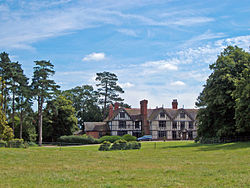
Buerton, Cheshire East
Buerton is a village (at SJ685435) and civil parish in the unitary authority of Cheshire East and the ceremonial county of Cheshire, England, about 7 miles south of the town of Nantwich and 1½ miles east of the village of Audlem, on the border with Shropshire. The parish also includes the small settlements of Hankins Heys, Moblake, Pinder's End and Three Wells, as well as parts of Chapel End, College Fields, Kinsey Heath, Longhill, Raven's Bank, Sandyford and Woolfall. In 2001, the total population was a little under 500, which had increased marginally to 503 at the 2011 Census. Nearby villages include Adderley, Audlem, Bridgemere, Hankelow, Hatherton, Hunsterson and Woore.
984 m
Moblake
Moblake is a hamlet in Cheshire, England. It is situated on Longhill Lane, approximately 2 miles (3.2 km) east of the village of Audlem, just inside the boundary of the parish of Buerton, Cheshire East.

2.1 km
Little Heath, Cheshire East
Little Heath is a village in the civil parish of Audlem, Cheshire, England. It is located to the north of Audlem, between Lonk Land and Audlem Road, the latter being part of today's A529 road.

2.1 km
Audlem Baptist Church
Audlem Baptist Church is in Woore Road, Audlem, Cheshire, England. It is an active Baptist church, and is recorded in the National Heritage List for England as a designated Grade II listed building.

2.4 km
Hankelow
Hankelow is a village and civil parish in the unitary authority of Cheshire East and the ceremonial county of Cheshire, England. The village lies on the A529, around 1.25 miles (2.0 km) north east of Audlem and 4.5 miles (7.2 km) south of Nantwich. The civil parish has an area 369 hectares (910 acres) and also includes the small settlement of The Dell and part of Corbrook, with a total population of just over 260 in 2011. Nearby villages include Aston, Broomhall Green, Sound, Hatherton and Buerton in Cheshire and Woore in Shropshire.
Hankelow is first documented in the 13th century, and the village historically had a school, two chapels, two public houses, a water mill, post office, shop and other facilities. Only a Methodist chapel – also used as a community centre – remained open in 2020. Two buildings are listed at grade II*: the 16th-century Ball Farmhouse and the 18th-century Hankelow Hall. Outside the village, the civil parish is predominantly rural and agricultural. The River Weaver runs in the west of the parish, and there is a small area of probable ancient woodland in the north east.