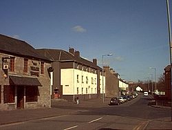
Faifley (Scottish Gaelic: Fionn Bhealach, IPA:[ˈfjuːn̴̪ˈvɛɫ̪əx]) is a large estate forming part of the town of Clydebank, Scotland, adjoining the former village of Hardgate, with a population of approximately 5,001. Along with Duntocher and Hardgate, Faifley falls within West Dunbartonshire's Kilpatrick ward with a combined population of 12,719 in 2011. Faifley has in the past undergone many changes with many of the older housing removed, re-built or renovated. Faifley has two schools each with a corresponding church; Edinbarnet Primary (Non-Denominational) with the White Church and St Joseph's Primary(Roman Catholic) with St Joseph's church. At the heart of the community until now, was "Boabs", a superstore conglomerate. The community centre also contained the Faifley Branch Library until it was closed in March 2011 by West Dunbartonshire Council. Faifley Library reopened on 6 December 2013 after a decision by West Dunbartonshire Council earlier that year. The Faifley Library is located at the rear of Edinbarnet Campus, off Craigpark Street, G81 5BS.

Lieux à Proximité Voir Menu
Location Image
1.6 km

Duntocher

Duntocher est un village situé dans le West Dunbartonshire en Écosse.
Location Image
2.8 km

Usine Singer de Clydebank

L'usine Singer de Clydebank est une importante usine spécialisée dans la fabrication de machines à coudre, située à Clydebank, près de Glasgow (Royaume-Uni). Ouverte en 1885 par la Singer Manufacturing Company, cette usine a longtemps été la plus importante usine de machines à coudre au monde. Elle a été fermée en 1980.
3.0 km

Kilbowie Park

Le Kilbowie Park (aussi parfois appelé New Kilbowie Park) est un ancien stade de football construit en 1939 et fermé en 1996, et situé à Clydebank.
Location Image
3.0 km

New Kilpatrick

New Kilpatrick ou East Kilpatrick est une paroisse civile d'Écosse dans le Dunbartonshire.
Location Image
3.1 km

Dalmuir

Dalmuir (en gaélique écossais : Dail Mhoire) est une zone située à neuf miles au nord-ouest de Glasgow, en Écosse, sur le côté ouest de Clydebank, et une partie de West Dunbartonshire Council Area. Le nom est un dérivé écossais du gaélique des lowlands signifiant « Grand champ ». La région était à l’origine deux villages séparés, Dalmuir Shore (uni à Clydebank en 1886) et Dalmuir Village (rattaché en 1906), au cours d’une période d’industrialisation rapide et d’expansion. Dalmuir est délimité par le village de Old Kilpatrick à l’ouest, les lotissements résidentiels de Mountblow et Parkhall au nord, et la zone du centre-ville de Clydebank à l’est. Au sud se trouve la rivière Clyde.