English
 Français

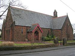
Auchinloch
Auchinloch (Scottish Gaelic: Achadh an Locha) is a village in Scotland, situated within the North Lanarkshire local authority area but very close to the boundary with East Dunbartonshire and sharing the G66 postcode of the town of Kirkintilloch and the adjoining village of Lenzie, located a short distance to the north. Other nearby settlements in North Lanarkshire are Stepps to the south and Chryston to the south-east, each approximately 1.3 miles (2.1 km) away across farmland and on the opposite side of the M80 motorway; the Glasgow City council area boundary and the suburb of Robroyston is about the same distance to the west. In previous years Auchinloch was in the Parish of Cadder and, from 1975 until 1996, the district of Strathkelvin within Strathclyde Region. The village's name - "Field of the Loch" - derives from its proximity to a small loch called the Gadloch. The area was sometimes known as the Loch Lands.
Lieux à Proximité Voir Menu